Victorian Philanthropist and Social Reformer. Talk by Micky Watkins
born 1813
Field Research Bill Bass reports: “Following our survey at Copped Hall near Waltham Abbey, Dennis Hill of the Enfield Archaeology Society asked HADAS if we could conduct a similar survey at a site in their area. This site is Bowling Green House in the grounds of Myddelton House just north of Forty Hall in the Bulls Cross area of Enfield.”
Myddelton House is named after Sir Hugh Myddleton, who constructed The New River in 1610-1614 to carry drinking water from natural springs at Amwell in Hertfordshire into central London along a 38 mile man-made channel. A section of this river once ran through the gardens but has now been filled in. Myddelton House replaced a Tudor building called Bowling Green House, the remains of which lie under the gardens, it was a 12 room, red brick, gabled structure that was demolished in 1812 when the present house was finished. This part of the garden is now a lawn and flowerbeds, in the 1980s when a water pipe was being laid, the gardener came across some brick foundations thought to be in the area of the Tudor House.
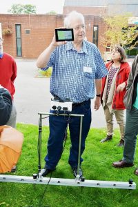
 Following a site visit (mentioned in the last Newsletter), we decided to conduct a resistivity survey over the weekends of the 13/14 and 20/21 October. The first weekend was completely washed-out weather wise so the survey was completed in one day (21st), which was also timed as a public open day so visitors could see what we were up to. Members of the West Essex Archaeological Group who had invited us to Copped Hall joined us. The survey went well in sunny conditions (at last!) we also set-up a bookstall where Andy Simpson tried to sell his wares (he wasn’t having much luck) and explaining what we were doing.
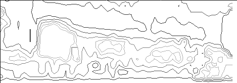 A 15 x 40m grid was laid out over the flat lawn known as Tom Tiddlers Ground with survey points at 1m intervals. Christian Allen compiled the results, (figure 1) shows a dot-density plot of the data. The plot strongly indicates a long linear structure across the northern half of the area. This appears to be part of a much larger structure. The contour plot (figure 2) shows that the structure has clearly defined edges, which implies that this is possibly a wall, its foundation, or similar construction. Given the strength of these results, the feature found is possibly a wall, or similar, belonging to a much larger structure. This implies that these may be part of the remains of the Tudor manor house that was previously situated in the grounds of the current Myddelton House. (See the results on page 2).
After the earlier site visit to Myddelton House the team were shown around a current excavation being carried out by the Enfield Archaeological Society elsewhere. The site to the south of the town near the A10 was in a small back garden but was turning up big results in the form of Roman finds pottery etc as well as post holes and gullies. The area is thought to be a possible farm perhaps near-to or adjacent to a Roman posting-station positioned on Ermine Street now followed by the line of the A10.
Note: From January 2002 Newsletter (Number 370).
Number 552 MARCH 2017 Edited by Deirdre Barrie
HADAS DIARY – LECTURE PROGRAMME 2017
Tuesday 14th March 2017: A Very Secret War: Trent Park & Bugging the Nazis in WW2, by Dr Helen Fry.
During WW2, British Intelligence bugged the conversations of over 10,000 German Prisoners-of-War at three clandestine stately houses. Trent Park was reserved for Hitler’s Generals – they were housed in luxurious conditions in what turned out to be one of the greatest deceptions of the wartime. Lulled into a false sense of security, the Generals relaxed and became unguarded in their conversations. They inadvertently began to give away some of Hitler’s most closely-guarded secrets. Having worked through the declassified files, historian Dr Helen Fry sheds light on one of the least-known, but greatest deceptions of WW2.
Historian Dr. Fry has written numerous books on the Second World War. Her book The M Room: Secret Listeners who Bugged the Nazis has been optioned for a feature film, and was the subject of the Channel 4 documentary Spying on Hitler’s Army. Helen has written over 20 books, including Spymaster: the secret Life of Kendrick; Freud’s War; From Dachau to D-Day; and Churchill’s German Army.
Tuesday 11th April: Where Moses Stood – Robert Feather.
Tuesday 9th May 2017: The Cheapside Hoard by Hazel Forsyth
Tuesday 13th June 2017: ANNUAL GENERAL MEETING
Monday 25th-Friday 29th September: HADAS Trip to Frodsham.
Tuesday 10th October 2017: “The Curtain” Playhouse Excavations, by Heather Knight, MOLA
Tuesday 14th November 2017: The Battle of Barnet Project, by Sam Wilson.
Lectures are held at Avenue House, 17 East End Road, Finchley, N3 3QE, and start promptly at 8 pm, with coffee/tea and biscuits afterwards. Non-members: £1. Buses 82, 125, 143, 326 & 460 pass nearby, and Finchley Central station (Northern Line) is a 5-10 minute walk away.
Mary Phillips – HADAS Vice President Jo Nelhams
Mary Phillips was appointed a Vice-President at the AGM on Tuesday 5th May 1992 at Hendon Library. At that time there were discussions concerning the high cost of the Garden Room at Avenue House, in which the Sunday morning group were already meeting. A member of HADAS at the time named Andrew Pares, who was a former Mayor, suggested that Councillor Mary Phillips should be invited to be a Vice-president as she may be able to be of assistance.
Although I was not a member of HADAS at the time, I did know Mary and had met her sometime in 1977. She was born in Finchley and lived in the area for all her life. As a child, she attended Manor Side School and later went to Henrietta Barnett School. During the war, so her daughter tells me, when the siren sounded, the girls would hide in a cupboard.
Mary trained as a teacher at Doncaster Training College and then returned to Finchley and met her future husband, Godfrey, at the Young Conservatives. Mary spent most of her teaching career at Goodwyn School in Mill Hill, which is where I met her.
She served as a Councillor for many years and was always trying to sort out people’s problems. She and her husband were very involved with the organisation of Finchley Carnival, and Mary also organised events for raising funds each year for the Mayor’s appeal, with a sponsored swim at Copthall Pool, as well as musical social events at Church Farmhouse Museum. She was also on many other committees. She was one of life’s “doers”. She maintained her interest in HADAS, and always read the Newsletters until this became impossible for her.
Mary passed away recently, and as I reported at last Year’s AGM, she was being cared for in a home in Cockfosters where she had been for a few years.
Congratulations to Dorothy Newbury
Surely our oldest member, Dorothy Newbury celebrated her 97th birthday recently. HADAS Committee and members send their best wishes and congratulations.
Archaeological Watching Brief – RAF Museum, Hendon
6 February 2017 Andy Simpson
This work was undertaken by Curator of Aircraft and Exhibits and member of local group Hendon and District Archaeological Society (HADAS), Andrew Simpson.
Site access via the contractors (SDC builders Ltd) was arranged by RAFM Centenary Programme Manager Rebecca Dalley and Steve Johnson, SDC Site Manager, to whom thanks. The provisional site code RAFMH17 was allocated. NGR TQ22079039.
Background
Much of the RAF Museum Hendon site is currently being redeveloped as part of a major Heritage Lottery Fund (HLF)-funded project to mark the Centenary of the Formation of the Royal Air Force (RAF) on 1 April 1918.
Part of this work involves major ground works to change the layout of the external parts of the site. To this end, the contractors have excavated a number of machine-cut trenches to check for services and ground conditions. On the western part of the site this involves the replacement of a large grassed area by car parking. This area served for many years as an occasional visiting helicopter landing pad and events area.
The Curator of Aircraft suggested that the opportunity be taken to investigate the excavated trenches for any archaeological features or finds of interest.
Until creation of the original aerodrome from February 1910, the area occupied by the RAF Museum and former RAF Hendon appears to have been low-lying and fairly boggy pasture land with many trees. The nearest major archaeological evidence lies to the east on the area of Greyhound Hill and Hendon Burroughs, where work by HADAS and others mainly since the 1960s has established evidence of undefined Romano-British occupation of first-fourth century date, possibly of agricultural/farming nature, plus evidence of Saxon occupation from at least the seventh/eighth century, and Saxo-Norman occupation; then virtually continuous occupation through to the modern day, other than a possible hiatus around the time of the Black Death.
In November 1992, a professional archaeological watching brief was carried out by Museum of London archaeologists, covering five machine-cut trenches, cut to a depth of 50cm, on the site of the new Colindale Police Station, within the former RAF Hendon East Camp, immediately adjacent to Hangar One (the former Battle of Britain Hall), found only underlying London clay, modern field drains and 17th-18th century pottery and clay pipe. (Site code GPW92; NGR TQ2193 9011). This was reported in HADAS Newsletter 261, December 1992.
Field drain cut Finds
It was suspected that similar material might be found at the museum site. Andy Renwick, Curator of Photographs and writer of “RAF Hendon The Birthplace of Aerial Power” (Crecy, 2012), suggested that field drains dating to RAF improvements to the site drainage in the summer of 1926 would be likely to be found. The London Aerodrome was created on land leased by the Brinckman family, with the area now occupied by the museum and its grounds forming part of one large field in the main, with a field boundary, as indicated by contemporary maps, running SW from roughly the centre of the current main building.
The Investigation
An afternoon was spent investigating three machine-cut trenches and their adjacent spoil heaps, and disturbed ground around the edges of the trenches, using a hand trowel only.
The first trench investigated was the long one running N-S at the centre of the former helicopter pad. The west-facing section was cleaned and showed a top turf humic layer some 5cm thick; all recovered finds appeared to originate from this context, 001. It overlay a hard-packed clay subsoil some 20cm thick, context 002, which appeared to be virtually sterile other than for one or two very small flecks of red brick or tile. This in turn overlay natural London clay, 003. Contexts 002 and 003 were cut by two lines of field drain running approximately east–west across the trench (presumed to be those laid in 1926 as referred to above), lying in an ash/clinker-lined cut, the ash/clinker including some fragments of modern pottery (not retained). The field drain sections in unglazed red earthenware fabric varied slightly in length, but a recovered example is 298mm in length with an external diameter of 11cm and a central bore of 75mm.
Recovered finds from this trench include three short lengths of updateable clay pipe stem, and a selection of modern stonewares and earthenwares. This was the trench with the least evidence of recent ground disturbance.
The second trench investigated, to the north adjacent to the main gate, showed much more evidence of recent disturbance, with a thick (20-25cm depth) but unevenly spread layer of ash/clinker running across the trench just below the turf/topsoil line (which was noticeably deeper in this trench – average 20cm), and overlying the natural London clay. Andy Renwick points out that in 1926 the little-used former railway spur running around the site boundary from Silkstream Junction on the Midland Railway main line across Aerodrome Road to sidings fronting the Edgware Road was lifted, and its ballast used to fill an area of boggy ground near the former Aerodrome Hotel; this may be more of that same material, lying just below the current turf line. Finds from this trench were limited to just three small sherds of pottery. Investigation was limited by waterlogging of much of this trench after recent heavy rainfall.
The third trench was the southernmost, just to the north of Hangar One. This again showed considerable evidence of recent disturbance, with much ash/clinker forming a layer between the topsoil and natural clay, containing modern pottery and glass including bottle necks. Site manager Steve Johnson suggested this may be redeposited rubble from the London Blitz. Certainly very similar material was used to backfill an uncompleted air raid shelter at Martin School, East Finchley, investigated by HADAS in 2013. Investigation was again limited by waterlogging of much of this trench after the recent heavy rainfall.
A brief check was made of two or three very small square trenches to the east of these three main trenches. These had been dug over the line of services and no features or finds were noted.
The Finds
A selection of the recovered finds was kindly examined by Jacqui Pearce FSA, pottery specialist for Museum of London Archaeology (MOLA).
There was a good selection of Victorian and later pottery from the central trench. This included a ribbed body sherd of stoneware – possibly a marmalade jar – a rim sherd of a bone china serving dish with floral decoration; part of a stoneware bottle; part of a redware lid, probably from a teapot; a section of handle from a Victorian Rockingham-type earthenware teapot, originally made near Rotherham in South Yorkshire (MOLA code ROCK, 1800-1900); and refined white ware body sherds. There was also a single piece of partially fire-melted green bottle glass, and a similarly fire-damaged sherd of stoneware, the latter two possibly analogous with the material from the Hangar One trench.
The three small sherds from the ‘Bloodhound Trench’ include two of Refined white earthenwares (MOLA code REFW, 1805-1900) – one a section of foot rim – and a rim sherd of Transfer Printed Ware (TPW, 1780-1900).
The trench nearest Hangar One yielded a selection of relatively recent material, including a complete small brown glass screw-top jar and a white glazed and almost complete possible salt shaker with a hole at base for adding the salt. There were two glass beer-type bottle necks in clear and brown glass, part of a stoneware jar/bottle base and several fragments of white glazed plates, both plain and decorated. All of this could well match the suggestion of dumped ‘Blitz Rubble’ in this area. There was also a small white ware sherd with the transfer printed maker’s mark ‘Grindley England’ – W.H. Grindley were a Potteries-based manufacturer based in Tunstall; this ‘sailboat’ makers’ mark being dated 1936-1954; see http://www.thepotteries.org/mark/g/grindley.htm
Conclusions
This was a useful exercise in confirming that in this part of the site at least there appear to be no significant archaeological features. It is interesting that the small selection of finds recovered are virtually all of Victorian or later date, with no sign of the earlier pottery recorded just next door on the Police Station site. Only the clay pipestems may be a little earlier, but clay pipes did remain in fairly general use until the Great War period, when supplanted by cigarettes. Any further site observation may be taken as appropriate, and the finds retained for possible formal/informal display to various museum stakeholders and audiences.
Cromer Road School History Award Jim Nelhams
Cromer Road School, where we dug in 2014 and 2015, has received a Silver Award from the Historical Association for their study of history over the last three years. Reports of the digs from Bill Bass have appeared in our Newsletters. The citation includes the following words: –
“The school keenly promotes learning outside the classroom and has been involved in a Big Dig project where pupils have undertaken their own excavations on the school site and surrounding area.”
It is nice to know the positive effect that the work of our digging team has contributed to the school.
Church Terrace Excavation – “the copper-alloy pin” Alec Jeakins
I dug on this site, and remember an excited Ted Sammes showing me this Saxon spiral-headed pin one morning at the start of a day’s digging. (See p.67 of “A Hamlet in Hendon” 2014)
Recently I was looking at the catalogue of “The Making of England – Anglo-Saxon Art and Culture AD 600-900” an exhibit which was held at the British Museum in 1991. A photograph on page 98 shows two very similar pins to the Church Terrace example from the S. Humberside, Flixborough site – a particularly well-preserved high-status site. The finds are in the Scunthorpe Museum. At the time of the exhibition, detailed analysis and phasing of the site had not been resolved, but it was stated that all the finds date from the eighth or ninth century.
The Flixborough pins are not mentioned in the “A Hamlet in Hendon” Report when reviewing other examples. These pins are slightly shorter than the Church Terrace pin, i.e. 570mm & 515mm rather than 161mm, and the spirals are not so tightly wound.
Add these two pins to the York find mentioned in the review, and it would suggest a wider distribution than that of the southern and eastern England suggested in the Church Terrace report.
Membership Renewals by Stephen Brunning
The HADAS membership year runs from 1st April to 31st March, and so all members who pay by cheque will now be required to renew (except those people who have joined since January this year).
Please therefore find enclosed a renewal form, and I would ask that you fill it in and return it to me along with the appropriate amount as soon as possible. The current rates and where to send your payment are on the form. Many thanks.
If the renewal form is not enclosed and you require one, please contact me – Stephen Brunning Email: stephen@millhill1.plus.com
Bank of England Notes Jim Nelhams
In September of 2016, the Bank of England introduced a polymer £5 note. One comment was that the new note would survive in a washing machine, though I have not had the courage to test it. Since the introduction, the old notes have started to be withdrawn.
After 5th May 2017, the old notes will no longer be legal tender, though they can be banked at banks, building societies and the post office, so when this Newsletter is issued, you have just over two months left to use them in shops. Current plans are to introduce a new £10 note featuring Jane Austen this summer, and a new £20 note in 2020. There are no plans as yet to replace the £50.
Bradford on Avon – Final Day Jim Nelhams
Our last day on the trip. And because our hotel was some distance from the town, denying us the opportunity of exploring, we now had a little time to rectify the omission. We had spent time at the Tithe Barn on Wednesday (see January newsletter). Most people started with the Saxon church, though Simon had been there on the Wednesday.
After “doing the town,” we boarded our trusty chariot for a visit to the Steam Museum in Swindon, and thence to another tithe barn, this one at Great Coxwell.
St Laurence’s Church, Bradford on Avon Simon Williams
The church was probably a chapel built to house the body of Saint Anselm. Tall and narrow, it is delightful in its unaltered integrity inside and out, save one missing porch, with a sense of being windowless – in comparison with subsequent trends: as a place of inner peace and refuge within the precinct of a monastery: a sanctuary from the savage and ‘Godless’ world outside? It has miraculously escaped the heavy hands of the Normans, Gothic ‘improvers’, and the C19 ‘restorers’; as testimony to an astonishing time-warp it still stands apart, dominant in its own space. Recorded to have been founded c.675-709; and to be forgotten through time. Escaping through change of use: the nave as a tiny school, the chancel as a tiny dwelling, only to be rediscovered in 1856. The fine external stone pilaster stripwork dates from C10-11.
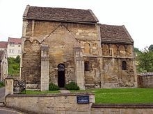 Only the austere Escomb Church near Durham, can rival it for age and preservation, though lacking its sense of place, being rather deplorably surrounded by a modern housing estate!
Bradford on Avon Museum Audrey Hooson
Today Bradford on Avon is an interesting, rather touristy market town. It is difficult to imagine it as the noisy, smoky centre of a manufacturing area. The local museum run, as so often, by volunteers, is housed in part of the modern Public Library building. Their room is quite small and densely packed with interesting exhibits. It was fortunate that our visit did not coincide with an excited school group.
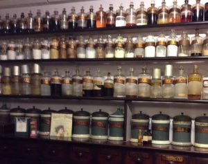 The sections on local industry and social history were particularly well displayed. The centre piece is the Christopher Shop. This pharmacy was established in 1863, and remained much the same until the final owner, Angela Mary Christopher, decided to retire in 1986. There was no buyer and the Bradford on Avon museum Society was formed to preserve the contents. This developed into the current museum, opened in 1990.
The Christophers were antiquaries and kept all the bottles, jars and pharmacy equipment from before the era of pre-packaged medicines.
Their shop has been reconstructed at one end of the museum, and the gleaming jars and mahogany shop fittings are very attractive. It is often used for films and TV when a period setting is required, usually for purchasing poisons
Past industry in the area has included weaving woollen cloth (first mentioned in 1540), iron and brass working, and vulcanised rubber manufacture (since 1848). It was a surprise to find that Moulton Bicycles were designed there in 1962 and are still made in the town.
In recent years, many of the industrial premises have been converted into private residences and shops are changing. The Museum Society retrieves and preserves as much as it can.
The Iron Duke Jim Nelhams
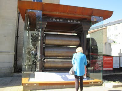
The Iron Duke (photograph below) is a piece of industrial archaeology of national importance. Built in 1849 for Stephen Moulton to start his rubber manufacturing business in Bradford on Avon, it was the first machine of its type in Europe. The Iron Duke is a rubber-rolling or calendering machine, vulcanising rubber and cotton fabric to make waterproof sheeting. The rubber industry grew to dominate life in Bradford.
When the Spencer Moulton factory closed in 1973, the Iron Duke was dismantled and stored at Bristol Museum, in the hope that one day it could be restored and put on public view. The Bradford on Avon Preservation Trust, the Bradford on Avon Museum Society and BoaCan (the Bradford on Avon Community area Network) joined forces to bring the Iron Duke back to Bradford on Avon, where it was a working machine for over 100 years.
The size and weight of the machine preclude siting it in the museum, so it was agreed to locate the restored Iron Duke on part of the old factory site. Planning permission was duly obtained and a shelter and a plinth designed.
The official unveiling of the machinery was to take place on 26th September, the day after we were leaving, but everything was prepared, including displays explaining the social, cultural and economic impact of the rubber industry on Bradford on Avon and surrounding areas.
The Iron Duke
The Bridge Micky Watkins
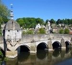
At first there was only a ford crossing the river, hence the name Bradford. In the Norman period a stone bridge was built, and ornamented with a little chapel. The weather vane on top of the chapel is a gudgeon – a fish was an early Christian symbol. A local saying for crossing the bridge was to go “under the fish and over the water.”
The bridge was widened and lengthened in the 17th century. In 1643 there was a skirmish on the bridge, and the Royalists seized control on their way to the Battle of Lansdowne. The chapel was converted into a lock-up for the town’s miscreants. The prisoners here were provided with a loo which drained directly into the river. They were more fortunate than most 20th century prisoners, as there was no slopping-out in the bridge prison.
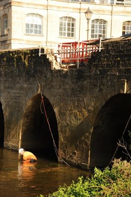
Post Script: shortly after our visit, traffic chaos hit Bradford on Avon, as the Town Bridge needed urgent repairs after a car ploughed into it on 3rd October, causing thousands of pounds’ worth of damage. The impact caused when a black Mercedes C180 crashed into the stonework just before 3am on Tuesday sent a three-metre chunk of the parapet hurtling into the River Avon.
Engineers from Wiltshire Council waded into the river to recover the stones, which can be re-used. It is understood the cost of repairing the Grade I listed structure could be around £10,000. (JN)
Temple of Steam Andy Simpson
Our penultimate call on the way back to London was to Swindon for the superb Steam Museum of the Great Western Railway – God’s Wonderful Railway or the Great Way Round, depending on your ‘Big Four’ pre-Nationalisation Railway Company affiliations!
Coming from Wolverhampton which once had two GWR loco sheds – one each for passenger and goods locos- plus Stafford Road Works, I’m not averse to a bit of polished brass and Brunswick Green – found here in abundance (along with a rare as hens-teeth loco works plate marked GWR Wolverhampton)
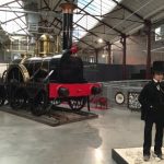
The GWR of course was the home of Brunel’s Broad Gauge – 7ft 0 ¼ inch as opposed to the standard gauge of 4ft 8 ½ inches – the Broad Gauge ended in May 1892 and relics are few, other than one original loco and three replicas. The one shown here along with a representation of the great man himself- – North Star – is a replica built by the GWR in 1925, incorporating the main driving wheels and name/works plates of the original of 1837, preserved from 1871 to 1906 then tragically scrapped ‘to save space’ at Swindon Works.
One of the first locos the visitor encounters is the magnificent 4073 “Caerphilly Castle” express passenger loco – once familiar to visitors in the splendid road and rail transport gallery at the Science Museum, South Kensington, from the 1960s through to the 1990s.
There are plenty of dioramas, signal levers to pull, loco footplates to step on and short films to watch. Swindon has had its own Railway Museum since the early 1960s, and after the tragic closure of Swindon Works by BR in 1985, part of the site was retained to house the new Steam Museum. Part of the adjacent works buildings now house a large shopping outlet – and another GWR ‘Manor’ class loco on loan from the Severn Valley Railway.
Also nearby is a major HQ building of the National Trust, and the home of the National Monuments Record.
For more details see http://www.steam-museum.org.uk/Pages/Home.aspx
https://www.historicengland.org.uk/images-books/archive
https://www.nationaltrust.org.uk/heelis
Great Coxwell Tithe Barn Vicky Baldwin
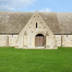
Described by William Morris as “unapproachable in its dignity, as beautiful as a cathedral, yet with no ostentation of the builder’s art” and “the finest piece of architecture in England “, Great Coxwell Barn was once part of a monastic grange owned by Beaulieu Abbey. Dating from c.1300, the walls were constructed from Cotswold rubble-stone, with ashlar blocks in the buttresses and doorways, and a Cotswold slate roof. The wooden frame supporting the roof rests on 6 pairs of stone pillars which divide the interior into 7 bays and 3 aisles. At 144ft x 38ft (43.94m x 11.63m) 5502sq ft (511 sq m) it seems enormous but is approximately half the floor area of the barn that stood at the Beaulieu St. Leonard’s home farm.
Externally, slit windows allowed for air flow rather than light, as did the putlog holes that supported scaffolding during construction. The main porched doorway is on the west (farmyard) side and, like most of the barn, shows evidence of the changes made over the centuries. In the opposite wall, facing the road, is a doorway with a smaller porch, incorporating a dovecote. The large openings in the gable ends are probably 18th Century in date.
The centre bay beyond the west porch was the threshing floor, and the pillars on either side of the east door have slots to hold the baffle board or ‘threshold’ that prevented the grain from being blown away during the threshing and winnowing processes. Crops would be delivered to the barn by the wagonload, stored, threshed, and then stored as grain either for use or (the majority) for sale.
Wagons would have drawn up to the west porch to be unloaded. Certainly the doorway appears not to have been wide enough to allow admittance, and there is a step up. As the interior of the east porch has tally marks, it is possible that grain to be sold was loaded out from there. In the upper part of the west porch there is evidence of a small chamber, possibly for the granger to oversee and supervise operations.
The security measures surrounding the processing of the harvest are evident in the following passage from a treatise of similar period:
“Give orders to your steward that your barns (graunges) everywhere are to be well secured after harvest, and that no servant or bailiff is to open them without special order or letter … until the time of threshing. And then send one of your faithful household servants who is to take with him the reeve and another faithful man. And these three men ought to be present at all times, at the opening and closing of the barns, at the threshing, the winnowing, and the transfer of the grain out of the grange – by tally – into the granary.”
Internally, the roof construction can clearly be seen. The complex system of supports, braces, beams, rafters, purlins and laths, held together with pegged joints familiar to a modern craftsman, would certainly have been interesting to William Morris. So interesting in fact, he was moved to add his name to the wealth of graffiti that adorn the walls. These are names, dates, daisy wheels (thought to be apotropaic), the interlaced ‘V’s that resemble a ‘W’ but in fact stand for ‘Virgo Virginum’, the ‘M’ for ‘Maria’, preparatory marks for further embellishment, and tally marks. It is not just time that has left its mark on the barn.
(Quotation on crop and barn security copied from the 1996 NT leaflet about the barn).
OTHER SOCIETIES’ EVENTS compiled by Eric Morgan
Wednesday 8th March, 6 pm Gresham College at Museum of London, 150 London Wall EC2Y 5HN. The Value of Heritage and the Heritage of Value. Simon Thurley. Free.
Friday 10th March, 7.45 pm, Enfield Archaeological Society, Jubilee Hall, 2 Parsonage Lane, junction of Chase Side, Enfield EN2 OAJ. The Must Farm Archaeological Project. Talk by Mark Knight, visitors £1. Refreshments, sales and information from 7.30 pm.
Thursday 23rd March, 6pm, Gresham College, Barnard’s Inn Hall, Holborn EC1N 2HH. The Rise and Fall of Sourdough – 6,000 Years of Bread. Fullbright Lecture, given by Professor Eric Pallant. (Covering food history of the Western World). Free.
Friday 7th April, 7.45 pm, Enfield Archaeological Society, Jubilee Hall, 2 Parsonage Lane, junction of Chase Side, Enfield EN2 OAJ. E.A.S. Fieldwork in 2016. Church House, Wood Street, Barnet (opp. Museum). Talk by Martin Bearne, preceded by AGM. Visitors £1.
Monday 10th April, 3 pm. Barnet Museum & Local History Society. Church House, Wood Street (opposite Museum). Hadrian’s Wall and Life on Rome’s Northern Frontier. Talk by Matthew Symonds. Visitors £2.
Wednesday 19th April, 7.30 pm, Willesden Local History Society, St Mary’s Church Hall, Neasden, NW10 2TS (nr. Magistrates’ Court). George Furness – Willesden’s Greatest Resident. Talk by Margaret Pratt and Cliff Wadsworth on one of Willesden’s greatest Victorians, running the local brickworks, building houses, roads and sewerage.
Wednesday 26th April, 7.45 pm, Friern Barnet & District Local History Society, North Middx. Golf Club, The Manor House, Friern Barnet Lane, N20 ONL. The Hunting of Hepzibah – a Family History with a Twist. Talk by Jim Nelhams (HADAS) £2.
Thursday 27th April, 8pm, Finchley Society, drawing room, Avenue House (Stephens’), 17 East End Road, N3 3QE. The Regent’s Canal (and Museum) by Roger Squires. £2.
 Number 551 FEBRUARY 2017 Edited by Andy Simpson
HADAS DIARY – LECTURE PROGRAMME 2017
Tuesday 14th February 2017; London Ceramics at the time of the Great Fire, by Jacqui Pearce
Tuesday 14th March 2017; Bugging the Nazis in WW2; Trent Park’s Secret History, by Helen Fry
Tuesday 11th April 2017; To Be Confirmed
Tuesday 9th May 2017; The Cheapside Hoard, by Hazel Forsyth
Tuesday 13th June 2017; ANNUAL GENERAL MEETING
Tuesday 10th October 2017; The Curtain Playhouse Excavations, by Heather
Knight, MOLA
Tuesday 14th November 2017; The Battle of Barnet Project, by Sam Wilson
Lectures are held at Avenue House, 17 East End Road, Finchley, N3 3QE, and start promptly at 8 pm, with coffee/tea and biscuits afterwards. Non-members: £1. Buses 82, 125, 143, 326 & 460 pass nearby and Finchley Central station (Northern Line), is a 5-10 minute walk away.
Post-Excavation Work – Medieval Cricklewood! Andy Simpson
As ever, Sunday Mornings at Avenue (Stephens) House continue in the usual vein with the ‘usual suspects’. Good work is again being done on the Clitterhouse Farm 2016 (site code CTH 16) excavation finds analysis, with all finds now washed and marked. The bulk finds sheets have also been completed. More medieval pottery has been identified from across the site, to supplement the three sherds of southHertfordshire type grey Ware (MOLA fabric code SHER, 1170-1350) found in 2015, including a body sherd of SHER and two body sherds of early south-Hertfordshire type coarse ware (ESHER) dated 1050-1200 – our first potential Conquest period pottery from the site.
Contemporary with these is a single small body sherd of early medieval coarse sand- tempered ware (EMCS, 1050-1200)
There is also a single body sherd of late medieval Hertfordshire glazed ware (LMHG, 1340- 1450). All of the 2016 medieval pottery is from disturbed residual contexts, unlike the SHER found in 2015 in a presumed primary ditch fill.
This is an exciting development pushing back the known chronology of the site.
Footpads Talk: A Reflection on Finchley Common robberies. Simon Williams
Simon adds some more local details following on from the report on the talk on footpads in South London by Margarette Lincoln in the January newsletter.
At its peak, Finchley Common was 5.0 km2; by enclosure (1816) it was reduced to 3.6km2; of mostly woodland—comprising Copetts Wood, Coldfall Wood & The Glebelands; it sprawled from East Finchley to Barnet.
The famous clown ‘Joey’ Joseph Grimaldi 1778-1837 (who single-handedly revolutionised the clown from the Shakespearean rustic buffoon to the version we recognise today: inventing face-paint, bright clothes, the pantomime catchphrase, combined with it’s star-act/pop personality- association, his one-time ‘Hot Codlins’ fame) was robbed on Finchley Common c.1800; he lived near the present Finchley Memorial Hospital. The Earl of Minto stated to his wife that he would not, “trust my throat on Finchley Common in the dark”. Edmund Burke MP was also a victim in 1774. Villains associated with the Common include Jack Shepard, Dick Turpin & the “Wicked Lady’s” lover (he was caught there).
Less famous were ‘Everett & Williams’ who went as far as to draw up a legally witnessed contract that they would split their plunder after a year’s work in 1725.Gibbets were in use here from at least the 1670’s, another was at Tally-Ho Corner.
A combination of the Enclosure Act, paper money which in 1797 was easily traceable (presumably because there wasn’t much in personal circulation?), together with the opening of the first bank in 1692 meant that travellers to London no longer carried huge amounts of gold on them.
The Bow Street Horse Patrol policed from Highgate to Barnet between 1805-51; was it finally stopped due to reduced traffic?- in the advent of the railway boom?
These possibly conspired to put the robbers out of business? As one looks at the bleak unforgiving municipal streets of Barnet today, albeit no Sylvan Idyll, we are all probably better- off?!
Bradford on Avon – Day 4 Jim Nelhams
Thursday started with a stop in the market town of Frome, from whence we moved on to Wells. It seemed that few of our group had visited Frome before, and although a number had been to Wells, few had visited the Bishop’s Palace. We started in Frome at the parish church on a hill above the town centre before making our way down Cheap Street to the Museum, yet another important organisation run entirely by volunteers.
St John the Baptist Church, Frome Dudley Miles
The original church was built in 685 by Aldhelm, Bishop of Sherborne and a leading Anglo-Saxon scholar. Virtually nothing survives of his church, and it was remodelled on several occasions, most notably in the thirteenth century, and in the Victorian period, when it had fallen into a derelict state and much of it was rebuilt by the controversial Anglo-Catholic priest, W. J. E. Bennett.
The Lady Chapel dates back to Norman times and has a Saxon window, as well as ten windows by the leading Victorian stained glass designer, Charles Kempe. Another survival is St Nicholas Chapel, now the baptistery, which dates to 1408 and has a fine thirteenth-century font.
Several of us were fascinated by two Saxon stones. The upper one, which dates to the eighth century, is part of a vertical shaft of a cross, while the lower one, which is ninth century, is a carving of an animal. Sadly, there is no evidence that the stones were part of the Anglo-Saxon church.
A unique feature is the nineteenth-century Via Crucis or Way of the Cross, a set of statues illustrating Christ’s road to Calvary on a processional way up the steps to the church. Unfortunately, the gate from the street to the processional way is now locked.
Cheap Street, Frome Beverley Perkins
Down the hill from the St John’s Church lies Cheap Street, the original shopping street of Frome (from the Saxon name for barter – ceap). Frome was granted a charter for a market in 1239 and the street itself dates from that period. However, the existing buildings were mainly constructed in the 1500s and, following a fire, in the 1830s. Although some half-timbered buildings with jettied upper storeys remain, the origins of most are disguised by more recent frontages and by modern shop windows at ground floor level. No. 11 Cheap Street, a Tudor house with overhanging jetties and massive beams carved with rosettes, is the oldest house in Frome. A narrow rivulet runs down the centre of the cobbled street – picturesque, but a hazard for walkers!
Frome is known for its Cockey lamps, unique to Frome and made in art nouveau style by local company Edward Cockey & Sons. Originally made for gas, they were later converted to electricity. One of these lamps spans Cheap Street in an elegant arch. For more information see https://fromemuseum.wordpress.com/collection/metalworking/cockey and for photographs see www.frometowncouncil.gov.uk/wp-content/uploads/2016/06/FromeCockey-Lamps-2016.pdf.
Frome Museum Claudette Carlton
Frome Museum is situated in a Georgian house. At present the Museum is located on the ground floor, but there are plans to extend to the upper floor of the building next year.
There is a very elegant staircase connecting the floors of the house.
The group was welcomed by Emma and David Robinson, members of HADAS, who, although resident in Colindale, spend a lot of their time in Frome. Emma is Chair of the Trustees of the Museum. Tea, coffee and very good cake were provided for the group, for which many thanks.
There is a fascinating cabinet of curiosities in the museum, pictorial records of the casting of bronzes in the Singer foundry in Frome, including that of Boudicca/ Boudicia, which now stands on the Thames Embankment and of Sheppards Mills, a textiles mill sited in Spring Gardens Frome. In its heyday children as young as 7 years worked there, 6am to 7pm, Monday to Friday, and up to 2pm on Saturday. The mill closed in 1878.
There was also a display of the record of one local man’s service in the Great War, his medals and other memorabilia; and another about Siegfried Sassoon, some of his poems, and a brief account of his life.
Many thanks to HADAS for allowing me to do this trip, and to the group for their good company.
Bishop’s Palace, Wells Ken Sutherland Thomas
On arrival in Wells, we were presented with a wealth of historic sites to visit including the Bishop’s Palace and the Cathedral.
On entering the Palace grounds and skirting the appealing coffee shop, I planned firstly to explore the gardens and to enjoy the views from the walkway on the ramparts. The Palace has been the home of the Bishops of Bath and Wells for over 800 years.
The gardens are about 14 acres in extent and include a number of pools (where the original wells were in times past the fresh water source for the local population).
Some of the pools afford wonderful reflections of Wells Cathedral.
I did not have time to explore the Arboretum which is also part of the grounds. With the time limited, I joined a group of visitors for a tour of the Palace buildings open to the public.
The Palace partly dates from the 13th century and work commenced on it when Bishop Joselin Trotman received a Royal licence to build a residence and Deer Park on land to the south of Wells Cathedral, St Andrews.
Our guide took us into the vaulted undercroft and then up an impressive staircase to what in past times would be the rooms where the Bishop ate and slept as well as entertained. We viewed the large gallery with many paintings of past Bishops as well as other artefacts.
Exiting the Palace, time allowed for a short visit to the ruins of the Great Hall. Built in 1290 for Bishop Burnell, the remains are the most impressive example of a Medieval open hall. It was built in Early English Decorative style. The remaining large windows frame beautiful views of the Cathedral.
Leaving the Palace grounds, I briefly joined many other visitors hoping to see the Wells Swans on the moat around the Palace. The swans are renowned for ringing a bell when it is feeding time.
Wells Cathedral Frances Radford
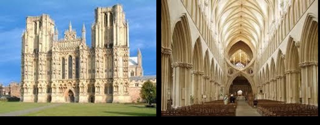 Wells is one of the most memorable of English Cathedrals due externally to the grandeur of the West Walls and internally to the unique scissor like structure which dominates the view from the nave.
The façade of the West Front presents as a giant screen intended for a display of statuary. The great breadth of the front is emphasised by two string courses which define three horizontal zones countered by the verticals of the buttresses.
The lowest section contained scenes from both Old and New Testaments. Above this, statues of knights and ladies, kings and queens, bishops and saints and above them a row of the twelve disciples. At the top, centrally placed, a figure of Christ in Majesty. St Andrew, the patron saint of the cathedral is represented.
Many figures were damaged or disappeared later, but in their original state were, no doubt, intended to educate and impress the public, underlining the importance of the Cathedral and the Christian religion. It must have been particularly impressive when the west front was painted in bright colours or red, blue and green, providing a dramatic background for religious processions such as on Palm Sunday.
The first thing that strikes you as you arrive in the nave is the extraordinary scissorlike structure at the entrance to the quire, built 1338. The pale colour of the stonework plus the unusual shape gives, at first glance, a modern feel to the building. Its pointed arch fits well with the Gothic arches in the nave, making it part of the whole. The scissor arches were erected on three sides of the crossing in order to support the tower, as it had begun to crack and lean. One cannot help but be amazed at the ingenuity and skill of these early builders – (without all our modern technology).
The great Jesse Window above the high altar shows Christ’s family tree from the beginning with Jesse, the father of King David. In the Lady Chapel, there are more windows of note, four out of five of which are completely composed of fragments of ancient glass rescued after the destruction the Cathedral suffered as the result of the Civil War (1662-7) and the Monmouth Rebellion (1685). These jumbled fragments assembled together have made very beautiful windows.
The Lady Chapel is an elongated octagon but open westwards so is not separate from the body of the Cathedral. The floor has an intricate pattern of Victorian style tiles in black, cream and terracotta, while above, the ribs of the vault become a central star, painted as a copy of the original decoration.
Outside this chapel is a tall brass lectern inscribed to Dr Robert Creyghton who returned after fifteen years’ exile. “His Sovereign Lord King Charles II made him Dean of Wells in 1660” and gave the lectern to the Cathedral.
The misericords, beautifully carved, and the carvings on the capitals and corbel stones give a picture of life at the workers’ level; man with toothache, man removing a thorn from his foot, trout stealers being beaten, and a sleeping cat: also the headstone said to be of master craftsman Adam Lock.
Alas, due to shortage of time, many other treasures were missed including the Chapter House.
P.S. Quote from The Cathedrals of England by Alec Clifton-Taylor (architectural historian and critic) re scissor structure…
“Although their mason-craft is much more agreeable than modern concrete, in their audacity, even starkness, they carry analogies with certain contemporary structures, especially bridges, in that material.
Accordingly, there are those who wax enthusiastic about the strainer arches of Wells; but the plain truth can only be that in a building so exquisitely detailed, so abounding in subtleties, they are a grotesque intrusion” What do you think?
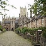
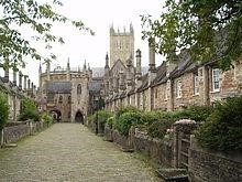
Vicars’ Close Katie McGrath
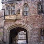
Vicars Choral, the men who sing in the choir at Wells Cathedral, have been established since 1140. In 1348 they were incorporated as a College of Vicars when the dining hall above the archway leading into the close came into use. This allowed them to transact their business and eat communally. The houses were completed by 1363. Originally there were 42 small houses forming a quadrangle with a chapel for the vicars at the far end, above which was their Library. In 1466 further alterations were made and the chimneys were raised and crowned with tall decorative octagonal stacks. Round about this time a Chain Bridge was built to link Vicars’ Hall with the Cathedral, and gardens were introduced. Following the Reformation in the 15th century the number of vicars was reduced and they were allowed to marry, so the houses were put together to form larger dwellings and Vicars’ Close took on its present appearance. Today, together with the choristers, the Vicars Choral sing services every day in term time. They still live in the Close, as do other members of the Cathedral foundation, including the Organist and Master of the Choristers. Altogether Vicars’ Close is an exceptional group of buildings and forms an important part of the whole Cathedral complex.
It is claimed to be the oldest purely residential street with original buildings surviving intact in Europe.
January Lecture Report – My Uncle, the Battle of Britain VC
by James Nicolson Lecture Report by Andy Simpson
A small group of HADAS members and visitors enjoyed this most informative talk.
The first-born son of the Nicolson family is traditionally called James. Our speaker continues the tradition with the eldest of his two sons. However, just to confuse matters, the subject of the talk – Wing Commander Eric James Brindley Nicolson VC DFC (29 April 1917 – 2 May 1945) was christened Eric, called Nick in the RAF, and
Bill by his family! Of some 150,000 aircrew on wartime ops in the RAF (of whom 55,000 died in Bomber Command alone), just 26 were awarded Britain’s highest military gallantry award, the Victoria Cross (VC), with Nicolson the only Fighter Command Recipient.
Nicolson was born at 38 Crediton Hill, Hampstead, living there until aged seven when the family moved to Shoreham, West Sussex. Always keen on joining the RAF, an initial attempt was unsuccessful so he joined a local engineering firm and became a keen amateur cricketer. Being 6ft 3ins tall he was a good bowler. He joined the RAF in October 1936, being posted to RAF Church Fenton in Yorkshire, flying Gloster Gladiator biplane Fighters with No. 72 Squadron. As Section Leader of three, his particular aircraft was serial number K6140. He became an accomplished display pilot, even broadcasting to the crowd during the 1939 air display. He and his fellow squadron members led a typically high-spirited off-duty life, racing their MG sports cars in reverse around the airfield!
He was careful however to give his ground crew five Players cigarettes each every Friday morning. The then standard battle formation of a ‘vic’ of three aircraft was too rigid. The two wingmen were meant to closely follow the leader and fire their four Browning machine guns each on his lead, concentrating so hard on keeping formation and not colliding with one another that they had little time to detect incoming attacking fighters. The Germans, with their much looser formations based on a ‘rotte’ (pair), even coined the term ‘row of idiots’ for this formation.
The 72 Squadron aircraft swapped all-over silver for hastily-applied camouflage at the time of the Munich Crisis in 1938. A telling group photo of Nicolson and his six Squadron chums at this time led to the recounting of the final toll – two badly burnt, two killed and two otherwise wounded. At this time he also met a farmers’ daughter from Tadcaster –Muriel, 13 years his senior. She was reluctant at first due to the age gap, but in July 1939 they commenced a happy marriage.
The VC was presented during an informal chat with the King at Buckingham Palace, his wife being allowed to attend also. Nicolson felt awkward and was ordered to wear his medal ribbon, which he usually hid by wearing an overcoat.
Fully recovered by September 1941 and keen to get back to flying, Nicolson was posted to India in 1942. Between August 1943 and August 1944 he was a Squadron Leader and C.O. of No 27 Squadron, flying Bristol Beaufighters over Burma, being very successfully teamed with his navigator and gaining the DFC and an old-beforehis-time look in photographs. During this time he was awarded the Distinguished Flying Cross and was involved with two squadron mascots – young bear cubs who rather outgrew their welcome. One was shot and the other eventually parachuted out over the jungle from a Dakota after he persistently returned to base!
As a Wing Commander, he was killed on 2 May 1945 when a RAF B-24 Liberator
‘R-Robert’ from No. 355 Squadron, in which he was flying as an observer for a bombing raid on Rangoon, caught fire and crashed into the Bay of Bengal after two engines failed.
Although he was one of four of the crew of ten who made it into a dinghy after ditching and were eventually found by a Catalina flying boat, he sadly drowned and his body was not recovered. He is commemorated on the Singapore Memorial.
Muriel Nicolson received the telegram informing her of his death on 8 May 1945 – VE Day. He left an estate of just £212, leaving Muriel in financial hardship; their son won a scholarship to Rugby School. She never remarried, living to over 100, and eventually sold his medals for £110,000 in 1983 – then a world record. They are now held by the RAF Museum at Hendon. The RAF Museum also holds Spitfire Mk 1 K9942 (at RAFM Cosford) flown by Nicolson with 72 Squadron in 1939-40.
An RAF VC-10 transport carried his name in the 1970s/80s and a Battle of Britain Memorial flight Hurricane carried the markings of his Hurricane for a while, along with a RAF Eurofighter Typhoon fighter for the 2016 display season.
Other Societies’ Events Eric Morgan
Thursday 16th February, 7.30pm Camden History Society Burgh House, New End Sq, NW3 1LT. Played in Camden – The Sporting & Recreational Heritage of a Borough at Play. Talk by Simon Inglis. Visitors £1.
Friday 17th February, 7.30pm; Wembley History Society English Martyrs Hall
Chalk Hill Road Wembley HA9 9EW (Top of Blackbird Hill, Adj. to Church) A Tour of Elizabethan London Talk by Nick Dobson Visitors £3. Refreshments available.
Thursday 23rd February 2.30pm Finchley Society Drawing Room, Avenue House
(Stephens House) 17 East End Road N3 3QE- Investigating our Local Community – Talk by Archer Academy Year 7 Students and Air Pollution Survey of North Finchley Talk by Chris Church Non-members £2 . Refreshments available.
Thursday 2 March 8pm Pinner Local History Society Village Hall, Chapel Lane Car Park, Pinner. Pinner’s Grand Houses & the People who Lived in Them – Presentation by Research Group – New Research by Society Members . Visitors £2.
Wednesday 8th March , 2.30pm Mill Hill Historical Society Trinity Church, The Broadway, NW7. Hidden Rivers at Stanmore Marshes Vicki D’Souza & AGM.
Wednesday 8th March, 7.45pm Hornsey Historical Society Union Church Hall, Corner Ferme Park Road /Weston Park N8 9PX Tottenham’s Forgotten Houses Talk by Val Crosby Visitors £2 Refreshments, Sales & Info from 730pm.
Monday 13th March, 3pm Barnet Museum & Local History Society Church House, Wood St, Barnet (Opp. Museum) The Jesus Hospital Almshouses Talk by Yasmine Webb. Visitors £2.
Wednesday 15th March, 7.30pm Willesden Local History Society St Mary’s Church Hall, Neasden Lane, NW10 2TS (Nr. Magistrates’ Court) The London Welsh School Talk by Elinor Delaney about its history and current activities in Willesden & Stonebridge.
Thursday 16 March, 8pm Historical Association; Hampstead & NW London Branch Fellowship House, 130A Willifield Way NW11 6YD (Off Finchley Rd in Temple Fortune) The First World War & The Middle East. Talk by Paula Kitching.
Saturday 18th March, 11am – 5.30pm LAMAS Archaeology Conference Weston Theatre Museum of London London Wall EC2Y 5HN Morning session – recent work. Afternoon session – talks on the Crossrail Project. Displays of work and publications. Cheque/PO payable to LAMAS plus SAE to Jon Cotton, Early Dept, Museum of London 150 London Wall EC2Y 5HN. See website www.Lamas.org.uk
Wednesday 22nd March, 7.45pm Friern Barnet & District Local History Society,
North Middx Golf Club, The Manor House, Friern Barnet Lane N20 0NL. East
Barnet- 100 Years of History. Talk by Richard Elby Visitors £2. Refreshments & bar
Friday 24th March, 7.30pm Wembley History Society English Martyrs’ Hall, Chalk
Hill Rd, Wembley HA9 9EW. Forgotten History of Kingsbury & Hendon Project – Part II Talk by J H Moher, continuing the story of our local Aircraft & Engineering Trades. Visitors £3. Refreshments in interval 50p.
Monday 27th March, 8pm Harefield History Society Park Lane Village Centre, Park
Lane, Harefield Middx Alice, Countess Dowager of Derby & Harefield; Myths,
Marriages & Milton. Talk by Prof. James Knowlee. (And also Monday 27th
FEBRUARY 8pm The Great Barn at Harmondsworth- Past, Present and Future Talk by Justine Bayley)
Thursday 30th March, 8pm Finchley Society Avenue House, East End Road N3 3QE Drawing Room. From Spare Bedroom to Woodside Park – The Early Years of the North London Hospice Talk by Harriet Copperman O.B.E. Non-members £2.
STOP PRESS! CURRENT ARCHAEOLOGY LIVE CONFERENCE 24-25
FEB; Subscriber rate £99, non-subscriber £139; See
With big thanks to this month’s contributors;
Eric Morgan; Simon Williams and Jim Nelhams and the Wiltshire trip reporting team: Claudette Carlton; Katie McGrath; Dudley Miles; Beverley Perkins; Frances Radford and Ken Sutherland Thomas.
No. 550 JANUARY 2017 Edited by Sue Willetts
We would like to take this opportunity to wish all our readers a Happy and Prosperous New Year.
HADAS Diary
Tuesday 10th January 2017: My Uncle, the Battle of Britain VC, by James Nicolson
Tuesday 14th February 2017: London Ceramics at time of the Great Fire, by Jacqui Pearce
Tuesday 14th March 2017: Bugging the Nazis in WW2: Trent Park’s Secret History, by Helen Fry
Tuesday 11th April 2017: to be confirmed
Tuesday 9th May 2017: The Cheapside Hoard by Hazel Forsyth
Tuesday 13th June 2017: ANNUAL GENERAL MEETING
Tuesday 10th October 2017: The Curtain Playhouse Excavations, by Heather Knight, MOLA
Tuesday 14th November 2017: The Battle of Barnet Project, by Sam Wilson
Lectures start at 7.45 for 8.00pm in the Drawing Room, Avenue House, 17 East End Road, Finchley N3 3QE. Buses 82, 143, 326 & 460 pass close by, and
it is five to ten minutes’ walk from Finchley Central Station (Northern Line). Tea/coffee and biscuits follow the talk.
HADAS Christmas Party Don Cooper
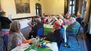 34 people assembled at Avenue House on Sunday 11th December for our annual Christmas event and a good time was had by all. This time not a buffet, but a sit-down meal preceded by canapes prepared and served by Malcolm and his staff. The tables were adorned with coloured table cloths and crackers and party poppers.
Table quizzes to check our knowledge were devised by Vicki Baldwin encouraging much cerebral exercise.
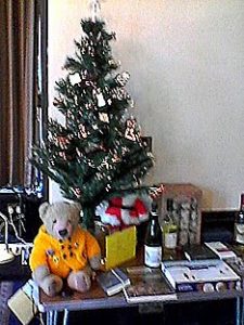 Musical entertainment was performed by Jo and Jim Nelhams and Andrew and Liz Tucker, and visual entertainment from Don Cooper sporting this year’s Christmas jumper and hat.
There was also a successful raffle – see photo for the great prizes. No Ted, of course, as he is the HADAS mascot. The food was concluded with tea / coffee and mince pies, and two splendid cakes, one fruit and one sponge both cooked by Liz Gapp.
Lovely to see two newer members, Annette Bruce and Joanna Fryer attending this event for the first time. Huge thanks to everybody who helped with the organisation.
London and Middlesex Archaeological Society, Walking through London’s History. 51st Local History conference – at Museum of London 19.11.2016 – short report.
The first presentation was from Prof. Caroline Barron and Prof. Vanessa Harding on Mapping Medieval and Early Modern London. They are working on a project to update the Historic Towns Trust’s map of London, c.1520 and they described the sources available to them. The HTT’s map appears in Mary Lobel’s 1989 book The City of London from Historic Times to c.1520 which needs correction and updating. They will use digital enhancement techniques and will include information from archaeological sources. NB It is not yet available so watch for an announcement in the near future. Below are abstracts from two more presentations – a fuller report appears in the LAMAS Newsletter Issue 149, January 2017.
A Footpad’s View of South London in the late Eighteenth Century – talk by Margarette Lincoln
This talk took us through the night-time, criminal activity along two major roads in South London which linked central London with naval dockyards and the continent. It focused on the last quarter of the eighteenth century, which experienced several notable crime waves, and considered whether the nature of highway robbery on one road was discernibly different from that committed on the other, looking at the impact of key taverns, local turnpikes and nearby convict hulks moored along the river. These all formed part of the local landscape for roadway travellers. Rampant street crime affected different social networks and both formal and informal steps were taken to police these two routes, with mixed results. The talk also considered how different crimes were reported in the newspapers: there were specifics that would help travellers to take precautions. Finally, the talk considered the effect that both routes had on the reputation of their localities (which can still be traced today), and therefore the legacy of eighteenth-century ‘walking’ for present Londoners.
Dr Margarette Lincoln is a Visiting Research Fellow at Goldsmiths, University of London, and Curator Emeritus at the National Maritime Museum, Greenwich, London, where she was Deputy Director from 2007 to 2015. Most recently, she edited the catalogue for the Museum’s special exhibition, Samuel Pepys: Plague, Fire, Revolution (2015). She is currently working on a book about eighteenth-century maritime London.
Paying for Passage: the impact of tolls on the 19th century London pedestrian – talk by Simon Morris
Pedestrians in London walked the streets for free, unless they happened to be using a tolled road or bridge. The first half of the 19th century saw the construction of a number of privately financed roads and bridges, many of which – unlike the regular bridges and turnpikes – charged not only carts and carriages, but also pedestrians for the right of passage. These bridges included major central crossings such as Waterloo, Southwark and Lambeth Bridges as well as suburban bridges such as Hammersmith, Battersea, Wandsworth and Deptford Creek. The only road on which a foot toll was charged was Highgate Archway, although Barking Road was interrupted by a toll bridge across the River Lea. This talk described where and why these roads and bridges were constructed, and the growing tension arising from their being built to create communication yet obstructing passage by erecting barriers and charging tolls. It also touched on the adverse social impact that a foot toll might cause, for example hindering poorer citizens wanting to cross the river to enjoy the newly opened Battersea Park, and also depressing the development of new housing in the neighbourhood. There was a growing campaign for the abolition of these tolls which, after many struggles, succeeded in the early 1880s.
Simon Morris is a member of the Council of the London Topographical Society and has a particular interest in the development and mapping of London; he is currently researching 19th century street signs. Simon studied law at Cambridge University and History at London University.
London Archaeological Prize 2016 and HADAS Don Cooper
The winners of this prestigious biennial prize were announced at the London Archaeological Forum on Monday 28th November 2016. There were nine publications on the shortlist.
The winner was “Temples and Suburbs, Excavations at Tabard Square, Southwark” by principle author Dougie Killock with John Shepherd, James Gerrard, Kevin Hayward, Kevin Rielley and Victoria Ridgeway published by PCA in 2015. It is available from Oxbow Books for £27
Second was “Roman Sculpture from London and the South-East, CSIR (Corpus Signorum Imperii Romani) Volume 1, Fascicule 10” by Penny Combe, Francis Grew, Kevin Heyward and Martin Henig, published by the British Academy and Oxford University Press. It is available from OUP for £120.
There were three publications cited with honourable mentions including: “A Hamlet in Hendon” by the HADAS Finds Group, published by HADAS in 2014. It is available from HADAS
(chairman@hadas.org.uk) for £20 plus p&p. The judge’s comment: This is an important book for Hendon and has obviously been the work of many years for the members of the society. It is a great achievement and covers a lot of material which will be of use and interest for many years to come.
A Generous Donation
HADAS has received a cheque for £100 from Dr Ann Saunders MBE to be put towards the cost of our next publication. Ann was president of HADAS from 1998 to 2001 and is a long-time influential member. We thank Ann for her generous donation and wish her well for the future.
BRADFORD Trip – Day 3 Jim Nelhams
Bradford on Avon – Day 3 Jim Nelhams
After an energetic day in Bristol, time to let the feet recover and let motors take the strain. Jo and I first encountered Bradford on Avon when we passed through on a narrowboat on the Kennet and Avon Canal. Our canal map showed a tithe barn next to the canal, so we went to investigate, and then looked round the town. It was on the same trip that we found Claverton, our second point of interest for the day. Time now for a second look. Our coach took us to the far end of the station car park from where a footpath leads along the river bank to the barn. Then from Bradford to Bath.
The Tithe Barn, Bradford-on-Avon David Bromley
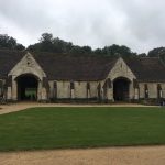
This impressive Grade 1 listed barn was built in the 14th century and was part of the medieval grange belonging to the nuns of Shaftesbury Abbey until its dissolution in 1539, when it then became a private farm until 1974. It forms part of a farm complex and dominates the farm yard. It is of fine cut ashlar masonry, double-skinned with a rubble fill and measuring 51 meters long by 10 wide. The side walls are 0.75m thick, the gable ends are 0.9m and have 4 external buttresses, two corner and two central.
Running roughly east-west, the roof is high pitched with stone tiles and projecting eaves. These tiles are hard limestone graded in size, getting smaller as they rise up the roof. Each is drilled and pegged with oak pins hooked over split oak battens. The estimated roof weight is 100 tons.
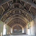
There are 14 bays divided by 13 trusses. Bays 5 and 10 form the porches which are larger on the north side to enable unloading of the wagons. These porches also provide a cross-draught needed for winnowing the corn. The thirteen crucks are individual pairs, each set on a stone foot, all at different heights. This was to make best use of local timber. Two are true single-tier crucks and the other 11 are two-tier crucks. Each truss is made up of about 100 cubic feet of English oak and weighs about 3 tons.
There are three tiers of wind-braces. The roof timbers have been dated between 1334 and 1379.
Each of the cruck frames has an external buttress built into the wall for added strength. Two of these, at the front west end, have been cut back to allow clearance for a horse engine, a beam pulled by a horse and connected via a shaft and gear to machinery inside the barn (chaff cutter or turnip chopper etc.). The roof was extensively repaired by the Ministry of Works in the 1950s.
Canal Trip from Bath to Claverton Pumping Station Liz Tucker
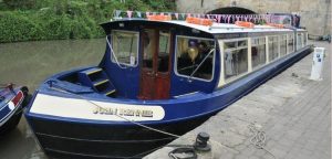 Whenever I go to Bath, I always imagine myself wearing a poke bonnet and a Regency style gown, in a Jane Austen costume drama. “It is a truth universally acknowledged” that this author wrote mainly about human relationships, ignoring events in the wider world during her lifetime. In fact, in her novels you can find references to naval battles and to the slave trade – but I cannot find any mention of the Kennet and Avon Canal, opened in 1810.
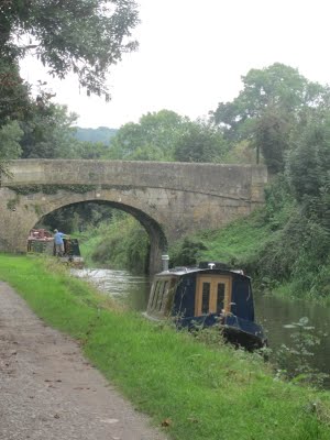
Starting at Bathwick, to avoid any locks, we glided along the canal for about three miles. We set off in an elegant, oak-panelled boat, called “The John Rennie” after the canal’s designer, who was responsible for numerous British canals and bridges. A broad beam boat, it only just got through a couple of short tunnels, sometimes bumping the sides. We saw five bridges, one a swing bridge; the first buildings we saw were halfway, at the small village of Bathampton, built of the Bath stone which was quarried locally.
After we rounded a bend, the scenery became more hilly. At last we reached the Claverton Pumping Station (to be described separately). This opened in 1813, for the purpose of topping up the canal when it lost water through the locks, or by leakage.
On the return journey we enjoyed a cream tea, while observing the various colourful boats, some with comical names such as “My Newt”, or with monkeys as figureheads. After two busy days, it made a nice change to sit and relax on a boat. It also made an interesting change to see a construction that was not by Brunel!
Claverton Pumping Station Stewart Wild
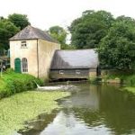
We disembarked from our canal boat right onto the canal bank and towpath. Then it was a short walk to reach the little lane that led downhill to cross the railway line – Stop, Look and Listen – and reach the old pumping station alongside a leat off the River Avon.
When this part of the K&A Canal was completed in 1810, under brilliant Scottish engineer John Rennie (1761–1821), it was necessary to overcome water supply problems. Fortunately at Claverton there was a convenient site close to the canal and alongside the Avon that had housed a water-powered corn mill. Rennie got his men to rebuild the mill and convert it to a powerful pump house, and it was working by 1813, supplying fresh water to the canal to replace that lost to leakage, evaporation and the operation of locks.
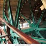
We split into small groups, each with a guide, to ease our way through the confined spaces in the 200-yearold building, which is Grade II listed. We admired the huge 24ft-wide wooden breastshot water wheel, over 17ft in diameter. When the sluices are opened, the wheel was designed to permit two tons of water each second to flow onto 48 wooden slats and propel it through one revolution every twelve seconds. Through gears and couplings, this energy translates to drive the vertical con rods powering the engine’s two cast-iron rocking beams, each weighing five tons, which in turn drive the 18-inch pistons of the lift pumps.
Since 1952 the power to the pumps has been provided by diesel-powered electric motors, which can pump up to 100,000 gallons per hour to top up the canal above. Rennie’s machinery had coped continuously until that year when much damage was caused by a floating log which trapped itself in the waterwheel. The problem may have been made worse by a lack of maintenance which until then had been the responsibility of GWR staff based at the Swindon works.
Then for fifteen years this lovely gem of industrial archaeology was left abandoned and derelict (by this time the lack of canal traffic meant little need for top-up water). However in the 1960s and 1970s restoration was carried out by students from the University of Bath under the supervision of the Kennet and Avon Canal Trust who replaced and repaired the buildings and equipment and returned the pumping station to a functional state by 1977.
From 1978 to 2012 the waterwheel and all other wooden parts and gears were replaced and rebuilt using Douglas fir from Scotland, and we should have seen it all in operation. Unfortunately there had been a few technical problems, but by the time you read this it should all be working well again, thanks to a dedicated band of the Trust’s volunteer engineers, some of whom have put in more than thirty years’ service.
Later the friendly guides showed us their upstairs workshop and mess-room, complete with original cosy Victorian range and hearth – we would have liked to have stayed longer to chat. Our thanks to them all for a most enjoyable and informative visit.
Archaeology in Hertfordshire: Recent Research, Ed. Kris Lockyear, Hertfordshire
Publications, 2015. Review by Bill Bass
“A Festschrift for Tony Rook” is the sub-title, Tony has been involved for many years in the archaeology of Hertfordshire as the Director of Welwyn Archaeological Society and has many publications behind him. This book is based on a conference to mark his 80th birthday in 2012.
The first couple of chapters puts the archaeology of Hertfordshire in context together with a potted history of the Welwyn Archaeological Society. Early papers include settlement and landscape from 1500BC – 300BC, much work has been undertaken since 1993. ‘The Baldock Bowl’ a Neolithic and early Bronze-age landscape area to the east of Letchworth is highlighted for its focus and use.
‘When was the Roman Conquest in Hertfordshire?’ The author here (Isobel Thompson) discusses the ‘transition’ of iron-age control to Roman administration. Further papers deal with the survey of Roman coins and hoards through archaeology. Continuing the ‘Romanisation’ theme Simon West (District Archaeologist) looks at recent work on several key sites around St Albans e.g. Folly Lane, Turners Hall Farm: Iron-age settlement to elite (?) Roman villa, Friars Wash Romano-British Temple complex, Six Bells: a bath house and possible mansio inside the walls of Insula XIX.
A Saxon hilltop cemetery near Watton-at-Stone is explored and there are a couple of useful chapters covering Hertfordshire fields, hedges, pollards and so forth and the evidence for use of land such as ridge and furrow ploughing techniques.
Lastly, the final chapter deals with ‘public engagement’ and community involvement/research in local archaeology under the ‘Dig Where We Stand’ Project. There were several initiatives to train people in different elements such as archaeology, archive research, oral history and digital technology. One of these projects was ‘The Hendon School Community Archaeology Project’ a collaboration between UCL and HADAS. A total of ten evaluation trenches over the years 2006-2012 provided a successful learning experience to students and teachers in a number of disciplines and aims.
Other Societies’ Events by Eric Morgan
20th December. 9.00 pm on BBC4. Digging for Britain. Shown before Christmas. It may be possible to catch up with this on BBC iplayer. The programme features Battle of Barnet archaeologist Sam Wilson.
Thursday 26th January. 2.30 pm. NB Earlier time than usual. Finchley Society, Drawing Room, Avenue House, 17 East End Road, N3 3QE. Thomas Reader White. Talk by Mick Crick. Non-members £2.00. Refreshments from 2.00 pm and after the meeting.
Tuesday 31st January. 1.00 – 2.00 pm. Society of Antiquaries. From the Dungheap to the Stars: the history of early gunpowder. Talk by Kay Smith FSA. Free but reserve seat in advance. To book online admin@salon.org.uk, or for more information: Tel: 020 7479 7080 https://www.sal.org.uk/publiclectures.
Wednesday 1st February. 6.00 pm. Gresham College at Museum of London, 150 London Wall, EC2Y 5HN. Perfection or Pastiche? New buildings in old places. Talk by Dr Simon Thurley on building big in historic cities. Free.
Friday 3rd February. 6.00 pm. Geologists’ Association. Geological Society, Burlington House. Piccadilly, W1J 0BE. On the Palaeolithic of Breckland: Old sites, new questions. Henry Stopes Memorial lecture given by Prof. Simon Lewis. Free.
Sunday 5th February. 10.30 am. Heath and Hampstead Society. Meet at Burgh House, New End Square, NW3 1LT The History and Topography of the Hampstead Heath Ponds. Walk led by Marc Hutchinson (Society Chair). Lasts approx. 2 hours. Donation £5.00.
Wednesday 8th February. 2.30 pm. Mill Hill Historical Society, Trinity Church, The Broadway, NW7. The Work of the War Graves Commission. Talk, speaker to be arranged.
Monday 13th February. 3.00 pm. Barnet Museum & Local History Society, Church House, Wood Street, Barnet. From Finchley to the Fatal Shore. Talk by Jackie Leedham. Visitors £2.00.
Tuesday 14th February. 1.00-2.00 pm. Society of Antiquaries, Burlington House, Piccadilly, W1J 0BE,
Revealing Verulamium: Community Heritage, Geophysics and the Archaeology of a Roman Town
Lecture by Dr Kris Lockyear FSA, and Dr Ellen Shlasko This lecture is based on the ongoing project ‘Sensing the Iron Age and Roman Past: Geophysics and the Landscape of Hertfordshire’. Doors open 12.30 pm. Public lectures are free and open to the public, but space is limited and reservations are strongly recommended to avoid disappointment. To book online admin@salon.org.uk, or for more information: Tel: 020 7479 7080 or https://www.sal.org.uk/publiclectures
Wednesday 15th February. 7.30 pm. Willesden Local History Society. St.Mary’s Church Hall, Neasden Lane, NW10 2TS. German Spies in the Kilburn Area.
Thursday 16th February. 8.00 pm. Historical Association: Hampstead and NW London Branch. Fellowship House, 136a Willifield Way, NW11 6YD (off Finchley Rd, in Temple Fortune) The French Invasion of England, 1216-17. Talk by Sean McGlynn on the invasion involving ‘Bad’ King John & the Barons’ revolt.
Friday 17th February, 7.00 pm. COLAS, St. Olave’s Parish Hall, Mark Lane, EC3R 7BB. Recent Excavations at the Curtain Theatre, Shoreditch. Talk by Heather Knight (MoLA) Preceded by A.G.M. Visitors £2.00. Wine and nibbles afterwards.
Wednesday 22nd February. 7.45 pm. Friern Barnet & District Local History Society, North Middlesex Golf
Club, The Manor House, Friern Barnet Lane, N20 ONL. Elstree – Britain’s Hollywood. Talk by Bob Redmond. Visitors £2.00 Refreshments including bar.
No 548 NOVEMBER 2016 Edited by Micky Watkins
Lectures start at 7.45 for 8.00pm in the Drawing Room, Avenue House, 17 East End Road,
Finchley N3 3QE. Buses 82, 143, 326 & 460 pass close by, and it is five to ten minutes’ walk from Finchley Central Station (Northern Line). Tea/coffee and biscuits follow the talk.
Tuesday 8th November 2016: The Cheapside Hoard, by Hazel Forsyth
Tuesday 10th January 2017: My Uncle, the Battle of Britain VC, by James Nicolson
Tuesday 14th February 2017: London Ceramics at time of the Great Fire, by Jacqui Pearce
Tuesday 14th March 2017: Bugging the Nazis in WW2: Trent Park’s Secret History, by Helen Fry
Tuesday 11th April 2017: to be confirmed
Tuesday 9th May 2017: to be confirmed
Tuesday 13th June 2017: ANNUAL GENERAL MEETING
Tuesday 10th October 2017: The Curtain Playhouse Excavations, by Heather Knight, MOLA
Tuesday 14th November 2017: The Battle of Barnet Project, by Sam Wilson
HADAS CHRISTMAS PARTY
This year’s party will take place in the drawing room at Avenue House, where we hold our lectures, on Sunday 11th December from 12:30 to 4:00p.m. A booking form accompanies this newsletter. Regrettably, the cost of the room hire and the food have risen so the price will be £30 per person. This cost includes the buffet lunch and the first drink.
Payment is required by Friday 18th November, but you can reserve your place early by notifying Jo or Jim Nelhams – contact information at the end of the newsletter.
The Long Trip, 2016 Jim Nelhams
On Monday 19th September. an intrepid group of 38 members, partners and friends headed west by coach for our annual long trip – this year based at the Best Western Leigh Park Country House Hotel on the outskirts of Bradford on Avon, near Bath. The Hotel, having accepted another group following our booking, were short of rooms, so we arranged for 5 extra rooms in a neighbouring converted barn. Our thanks to those who used that facility.
After a brief comfort stop on route, we headed to the town of Devizes, where the coach dropped us at the Wiltshire Museum. Here we met up with Beverley Perkins and David Bromley, who moved a few years ago to Devon but have remained members. They joined us for the remainder of the trip. A bonus at the Museum, was meeting up with long standing member Sigrid Padel. Sigrid moved in the summer to the New Forest, but drove up to spend time with us. It’s so nice to see old friends and good that they keep in touch. And later in the week we planned to meet up with David and Emma Robinson – more of that to come.
Devizes Jim Nelhams
Devizes is a market town and civil parish in the heart of Wiltshire. Its castle, started in 1080, was destroyed in the civil war in 1648 on the orders of Cromwell. It was later reconstructed in private hands and now contains flats, so is not accessible to the public.
The town now has four Church of England parish churches, and we visited the church of St John the Baptist, close to the museum. St John’s also stands close to the castle and may have begun as its chapel. The oldest parts of the building are from 1130, shortly after Roger, Bishop of Salisbury, rebuilt the castle. Pevsner writes “A major Norman church, dominated by a mighty crossing tower …”
The western part of the church was rebuilt in the 15th century with restoration carried out in 1844 and 1862-3, including the west front designed by Slater. The ornate Beauchamp south chapel is similar to the 1492 Beauchamp and Tocotes chapel at Bromham; the north Lamb chapel has a fine panelled ceiling. The organ case is late 17th century.
On the north side of the churchyard is a millennium cross, erected in 2000, with panels showing local scenes and trades. The museum had kindly arranged for us to park our coach at the Wadworth Brewery at the opposite end of the town, providing a target for our walk through the town market place
The Wadworth Brewery sits at the north end of the town. The company was established in 1875 when it purchased the Northgate Brewery, and moved to the current site to allow expansion. The brewery still uses two of the very few remaining ‘working’ Shires in the brewing industry in Britain to deliver beers, wines and spirits on weekdays (weather permitting) to pubs within a two mile radius of the Brewery. Working as a pair; they are able to transport a load of approximately two tons.
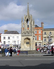 The first known market in Devizes was in 1228. The original market was in the large space outside St Mary’s Church, rather than in the current Market Place, which at that time would have been within the castle’s outer bailey.
The chief products in the 16th and early 17th centuries were wheat, wool and yarn, with cheese, bacon and butter increasing in importance later.
In the early 18th century Devizes held the largest corn market in the West Country and also traded hops, cattle, horses and various types of cloth. Before the Corn Exchange was built in 1857, the trade in wheat and barley was conducted in the open, with sacks piled around the Market Cross.
The town sits on top of a hill and such was its importance that the Kennet and Avon canal which links Bristol to London, opened in 1810, was routed up the hill and through the town. A total of 29 locks raise the canal including a flight of 16 locks mounting Caen Hill. On the canal quay is a small museum run by the Kennet and Avon Canal Trust, giving information about the development of the canal, its falling out of use, and the subsequent restoration, as with many canals, following the efforts of hundreds of volunteers. It also includes working models of the Crofton pumping station which we visited in 2015 and the pumping station at Claverton we would visit later in the trip.
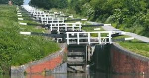 Leaving the brewery in our coach (a few more horsepower), we made a brief stop at the foot of the
Caen Hill flight of locks to provide a chance for photographs. Thence onwards to our hotel in Bradford on Avon, passing through Melksham where an Hawker Hunter jet fighter stood at the side of the road.
Devizes Museum Don Cooper
Devizes Museum, more correctly called Wiltshire Museum (it is the county museum), is housed in two Grade II listed early Georgian town houses with a Victorian infill and modern additions. The modern additions include lifts and ramps to all floors and up-to-date toilets. The museum concentrates on Wiltshire county heritage and is organised by time periods, although Upper Floor C tells the story of Devizes. The museum is a charity and dates from 1853.
All time periods are well represented with the four “Prehistoric Wiltshire” rooms being particularly good, highlighting the rich prehistoric landscape of Wiltshire which includes Stonehenge and Avebury.
However, the item that caught my eye was a fossil – a sponge fossil. These sponge fossils seem to have been put to a number of uses.
Some have been found used as money storage or perhaps money boxes (see photo). The Celtic gold coins are replicas of the ones found and there have been at least two other sponge fossils found that had been used for this purpose. The coins were Iron Age and were found at Chute in 1927 and more in 1986 and 1994.
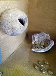 Another use illustrated was pigment holders. These fossils when split in half make a good small mixing bowl when applying colour to an object.In the prehistoric gallery there was a beautifully shaped sponge fossil used to make the head of a mace. It had been partly drilled through and polished, giving the head of the mace a striking look.
Figure 1 Sponge fossil used as a money box .
The museum is representative of the best kind of county museum. The artefacts are well labelled, the staff helpful and friendly, and there is a good selection of local books and guides. This visit was a great start to our stay in Wiltshire.
AUTUMN TRIP 2017
Although we have only just returned from our trip to Bradford on Avon, hotels are requiring that bookings for groups are made well in advance. So we are happy to announce that the trip next year will run from Monday 25th to Friday 29th September based at the Best Western Forest Hills Hotel in Frodsham, close to Liverpool and Chester. For the more energetic, the hotel boasts a gym, sauna, jacuzzi and swimming pool.
Prices will remain as this year at £470 per person sharing a twin/double room and £520 per person in a single room. A deposit of £125 per person will be required next March.
This year, several members brought friends on the trip, which is good because it helps share the cost of the coach and keeps the price down. They are more than welcome.
Please let Jo or Jim Nelhams know if you are hoping to come – so that we can reserve sufficient rooms. Contact details are at the end of this newsletter.
Bristol – The Avon Gorge and Henrietta Barnett Micky Watkins
In the 1890s, Henrietta and her husband Canon Samuel Barnett visited Bristol for three months every summer because Samuel was made a Canon of Bristol Cathedral. It was a welcome change from their life and work in the slums of Whitechapel. They used to walk and bicycle in the surrounding countryside. Henrietta saw that the Avon gorge was defaced by stone-quarrying, bare expanses of stone overtaking the woodland. Henrietta, with her secretary Marion Paterson and her adopted daughter Dorothy and friend, scattered flower seeds on the cliffs:
“First the seeds had to be collected; and then in the back garden, the children and I mixed them with earth, stirring all sorts together in the breadpan in Christmas pudding style. Then the packets were made about the size of a tennis ball and tied up in newspaper, and in the evening, in the gloaming, we went out like four conspirators down over the rocks.
Samuel carried the heavy baskets for them but would not throw the parcels because it was illegal. They were all delighted when “the bare rock produced antirrhinum, valerian, yellow alyssum, wild convolvulus, and, undoubted proof that they were the babes of our balls, Iceland poppies of the same strains as grew in our garden.”
The cliffs of the Gorge were purchased by George Wills, cigarette millionaire, to give to the public. When we approached the bridge we saw information about the flora of the cliffs, and the importance of this site of scientific interest. But no mention of Henrietta!
Battle of Barnet snippet Don Cooper
From the Barnet Museum & Local History Museum – August 2016 edition, a report on the Battle of Britain Project:
“In May a team of volunteers helped Sam Wilson [the project leader] with test-pitting in the area that used to be Kitts End Hamlet to try and establish how old the settlement was. They found lots of fragments of pottery and tile which have been dated by the British Museum to the whole medieval period (C11th to C15th), which indicates that the settlement was in existence at the time of the
Battle of Barnet.”
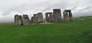 Stonehenge at Risk? Micky Watkins
Archaeologists and conservation groups are deeply split in their views about the Government announcement of the proposal to bury the A303 in a tunnel under Stonehenge.
English Heritage and the National Trust – owners of the site and the surrounding landscape – are jubilant. But Kate Fielden, representing the Stonehenge Alliance of conservation groups, Friends of the Earth the archaeological group Rescue and Aslan – whose members include pagans and Druids – all say that this short tunnel will cause serious damage to the historic landscape on each side.
Anyone who has used the A303 in the summer will know that the traffic jams extend for miles each side of Stonehenge and something must be done. More acceptable solutions are to make a longer tunnel, or by-pass the site, possibly using the A30 which runs parallel to the A303.
King Arthur’s Palace
A royal palace dating from the 6th century has been discovered at Tintagel. This is the probably the birthplace of the legendary King Arthur.
Cornwall Archaeological Unit is excavating the site. They have found many fragments of pottery and glass which had been imported from Europe and the Middle East by the wealthy people who lived here. There are sherds of imported late-Roman amphorae, fragments of fine glass and of Phocaean red slip-ware which was made in Turkey. In exchange, tin was exported from Cornwall.
Tintagel is one of the most important sites in Europe. Here the Romano-British rulers fought the Anglo-Saxon invaders for control of the island in the fifth century. The castle was built later, in the 1230-40s, by Richard, Earl of Cornwall, brother of Henry III.
Surely Arthur must have lived, for in the sixth century the monk Gildas wrote about him. If Gildas was fabricating a history it would have been disproved by old people with long memories. (Ed’s note: Arthur is not mentioned in Gildas)
The team is supported by English Heritage and this three week dig will be followed by further digs for the next four years.
Newly Excavated 1st Century Roman Bath in Pompeii
The entrance to the bath is through a portico from which you walk through to the changing room which is frescoed with eight numbered erotic scenes of different positions. Above the baths were prostitutes’ rooms. The changing room is floored with marble and the ceiling has stucco reliefs of cherubs and chariots. The cold plunge pool is frescoed with seascapes.
Other newly opened buildings are a merchant’s richly decorated house, a middle class house and a business where the people brought their fabrics to be cared for (dry-cleaners?).
The baths were badly damaged by the earthquake of 62 AD and were still being repaired at the time of the eruption of Vesuvius in 79AD which accounts for the absence of any statues or furniture.
OTHER SOCIETIES’ EVENTS Eric Morgan
Friday 4th November, 7.30 pm. Barnet History Society, Chipping Barnet Library. Gillian Gear Memorial Lecture: Warwick’s War by Karen Clark. Visitors £5.
Wednesday 16th November, 7.30pm. Willesden Local History Society, St Mary’s Church Hall, Neasden Lane, NW10 2TS (near Magistrates’ Court). The Willesden Green Cat Mosaic. Talk by Debra Collis.
Wednesday 30th November – Tuesday 6th December. Barnet Borough Arts Council, The Spires, High St., Barnet EN5 5XY. Art & Info. Exhibition (incl. HADAS details). Part of Barnet Xmas Fair, showing paintings, prints, photographs and textiles.
Friday 2nd December, 7.30 pm. Wembley History Society. English Martyr’s Hall, Chalkhill Rd, Wembley HA9 9EW (top of Blackbird Hill, adj. to church). The Forgotten Industries of Old Kingsbury and Hendon. Talk by Jim Moher, followed by mince pies. £3.
Saturday 3rd December, 9.45 am.-5 pm. Thames Discovery Programme, Foreshore Forum, National Maritime Museum, Greenwich SE10 9NS. Hear Updates from Frog Teams and Speakers. Tickets £20 & booking fee from:
www.thamesdiscovery.org/events/foreshore-forum-2016
Wednesday 7th December 6pm. Gresham College at Museum of London. Tough Choices: Heritage or Housing? Talk by Dr Simon Thurley. Free.
Monday 12th December, 5.30 pm. Society for Post-Medieval Archaeology, Society of Antiquaries, Burlington House, Picadilly. AGM followed by 6pm drinks reception, then 7pm. The Great Wall and the Ceramics Trade, by David Barker. Free, but book at:
www.spma.org.uk
Tuesday 13th December, 6.30 pm. LAMAS, Clore Learning Centre, Museum of London.
Investigations on the Site of Shene Charterhouse undertaken by MOLA and Richmond Archaeological Society in 2011-15. Talk by Bob Cowie (MOLA). Visitors £2. Refreshments from 6 pm.
Tuesday 13th December, 7.45 pm. Amateur Geological Society, The Parlour, St Margaret’s Church, Victoria Avenue, N3 1BD (off Hendon Lane). Our Heritage – Stone Tools and Rock Art. Talk by Bob Harris.
Wednesday 14th December, 2.30 pm. Mill Hill Historical Society, Trinity Church, The Broadway NW7. Whitefriars Glass – The Harrow Years. Talk by Mike Beech.
Comments
No. 547 OCTOBER 2016 Edited by Vicki Baldwin
HADAS DIARY
Lectures start at 7.45 for 8.00pm in the Drawing Room, Avenue House, 17 East End Road, Finchley
N3 3QE. Buses 82, 143, 326 & 460 pass close by, and it is five to ten minutes’ walk from Finchley Central Station (Northern Line). Tea/coffee and biscuits follow the talk.
Tuesday 11th October 2016: Women in Medieval London by Professor Caroline Barron
Tuesday 8th November 2016: The Cheapside Hoard by Hazel Forsyth
Tuesday 10th January 2017: My Uncle, the Battle of Britain, VC by James Nicolson
Tuesday 14th February 2017: London Ceramics at time of the Great Fire by Jacqui Pearce
Tuesday 14th March 2017: Bugging the Nazis in WW2: Trent Park’s Secret History. by Helen Fry
Tuesday 11th April 2017: to be confirmed
Tuesday 9th May 2017: to be confirmed
Tuesday 13th June 2017: ANNUAL GENERAL MEETING
Tuesday 10th October 2017: The Curtain Playhouse excavations by Heather Knight MOLA
Tuesday 14th November 2017: The Battle of Barnet Project by Sam Wilson
New Tours of the WCEC at the British Museum. Audrey Hooson
The British Museum has now started offering free tours of the World Conservation and Exhibition Centre to the public. They are on the last Tuesday of each month in the afternoon with four 80 minute sessions available and need to be booked in advance.
A different department will be featured each month:- 25th October – Western Art on Paper
29th November – Eastern Art on Paper and Silk (Hirayama Studio)
13th December – Ceramics, Glass and Metals. I have done this tour and it is very interesting.
For more information see the Events calendar on the BM web site. To book email volunteers@britishmuseum.org.
Hendon Open Day Don Cooper
 HADAS was very well represented at the Hendon Open Day that took place at the Hendon Baptist Church in Finchley Lane/First Avenue. The event took place on 3rd September 2016.
The event was instigated by Pastor Errol Jacobs in discussion with Jacqui Pearce, a pottery specialist, from the Museum of London Archaeology. HADAS were asked to participate. The format of the day was short presentations of the history of Hendon through the ages, illustrated by slides and photos of old postcards. Each presentation was about twenty minutes long Jacqui Pearce gave almost all of the presentation and there were individual presentations one each by Vicki Baldwin and Don Cooper.
HADAS set up tables with artefacts from the various digs in Hendon done by HADAS members as well as finds from excavations in the London Borough of Barnet, notably the Moxon collection from the Brockley Hill Roman pottery. We also displayed some of our books and publications.
Memories, the shop at 130-132 Brent Street, also displayed old photos, postcards and maps from their collection.
Refreshments were provided by the Church. There were tours of the Church by Mike who told us all about the fascinating history of the Hendon Baptist Church which was built in the 1880s.
Whilst it would have been good if more visitors had come along to this excellent event, those who came thoroughly enjoyed it. Thanks go to Rev Errol Jacobs for the use of the hall, Jacqui Pearce for her organisation and excellent presentations, to “Memories” for the loan of their collections of photos etc. and also to the HADAS crew led by Bill Bass who put it all together.
Hendon Baptist Church Peter Pickering
The day was held in Hendon Baptist Church Hall, which is the basement of the church; there are pillars which run through the basement and church up to the roof. Mike told us something of the history of the Baptist denomination in Hendon, and the building of the church, and took a tour round it. It is an aisled cruciform building erected in 1883; it was designed by J. E. Sears in an individualistic version of 13th-century Gothic. Mr Sears was a qualified architect member of the congregation, and had an interesting career as a politician; he was a Progressive member of the London County Council, and from 1906 to 1910 Liberal Member of Parliament for Cheltenham. But I have not been able to find any more buildings that he designed.
The church is obviously well-used and cared-for, and did not seem to have suffered from the re-orderings that can obscure original features; the roof was particularly fine. To those of us more used to Anglican churches there were strange as well as familiar features. No pictorial glass in the windows, for instance. Baptists practise baptism of adults, by total immersion, and at what I thought of as the east end, besides a pulpit and a communion table there is a trough in which baptisms take place. (Unfortunately, it was covered over when we were there, but the trapdoor above it is to be seen.) The organ has pride of place, and we were shown the pumping handle by which it used to be powered (and still can be if the electricity fails). The church is on a sloping and elevated site; there is a lift so that the less agile do not have to climb the many steps.
Remembering 1916 – in South Croydon Stewart Wild
I recently visited an excellent World War I exhibition at a school in South Croydon, just off the Brighton Road. It was due to end on 31 August, but due to its success it has been extended well into next year, in fact to 16 April 2017.
The exhibition is located in a hall in the grounds of Whitgift School and is the brainchild of headmaster Dr Christopher Barnett, who gained his doctorate in history among the dreaming spires of Oxford. It took him and his team of trustees, staff and pupils three years to gather a remarkable collection of WWI artefacts from a number of museums and private collections, and to build the exhibition panels and displays on the school premises.
The results are spectacular. All the might and wealth of the Imperial War Museum could not have done better. And to cap it all, they have created a splendid and authentic Edwardian cafe for visitors to relax in, complete with period decoration and furniture.
It took me nearly three hours to see it all, after which I was in need of an Edwardian sandwich and cup of tea. You begin with displays of 1914 recruiting posters and enlistment, after which the accent is firmly on 1916, the year of the terrible carnage on the Somme, the Battle of Jutland, the death of Lord Kitchener and the appalling loss of life at Gallipoli and Verdun.
It was also the year of the Zeppelin airships, the first aerial bombardment of London, and the heroism of Lt William Leefe Robinson, who won the V.C. for being the first to shoot one down.
The exhibition is not in any way triumphalist, and Dr Barnett has gone to great lengths to include French and German voices too, using excerpts from letters, diaries and memoirs. Throughout you are reminded that this is a giant history lesson too.
The team has built several realistic dioramas, not only of front-line tunnels and trenches, but also of an Edwardian parlour on the home front as a reminder of the awful unwanted telegrams that were delivered to grieving households all over the country.
One especially interesting item I found was a postcard from somewhere in France addressed to Mrs W R Wilkes, 21 Highwood Avenue, North Finchley, London N. Dated 19.4.16, the message began “Dear Ma and Pa” and complained mainly about the weather. Unfortunately their son’s name was not legible.
Among the displays of guns, grenades, bayonets, knives and even a knuckleduster, there’s also a range of things the poor Tommies treasured most: soap, foot powder, tobacco and letters from home.
A century-old Sunbeam bicycle and a Triumph motorcycle can be examined in detail. Bruce Bairnsfather’s books and renowned ‘Old Bill’ cartoons bring a touch of light relief.
There are two flags from the Battle of Jutland, an ensign from the British light cruiser Southampton and one from the German battleship Von der Tann. In contrast is an unpublished diary account of what happened as the battle began on 30 May 1916 by a crew member of HMS Inconstant, presumably written with Stephens’ famous blue-black writing fluid since the handwriting hasn’t faded.
The summer of 1916 was also when the Royal Flying Corps first crossed swords with German flying ace Manfred von Richthofen, the ‘Red Baron’. The exhibition features a lot about this legendary character since his first victim, in September 1916, was an Old Whitgiftian named Lionel Morris.
By an extraordinary quirk of fate, it was also an Old Whitgiftian who performed the autopsy on the Red Baron when he was finally shot down over Amiens two years later. Imaginative displays tell the whole story.
The exhibition is open daily, 10am to 5pm and there is free parking on site. Alternatively, the Whitgift Exhibition Centre is ten minutes’ easy walk from South Croydon station.
Further information: www.remembering1916.co.uk
Glasshouses Vicki Baldwin
During a recent visit to Heligan in Cornwall I was struck by the variety of structures that fall under the description ‘glasshouse’ and how they were adapted to fit situation and purpose. There were coldframes, lean-tos, full height, half-height, the ‘pineapple pit’ utilising horse manure to produce heat, and portable single plant covers. They were built into corners and against south-facing walls to maximise warmth. Access was by door, sliding panel, hinged window or, in the case of the very small examples, removable top.
These glasshouses not only enabled the gardeners to produced food all year round, but also allowed for experimentation and the growing of more exotic species such as melons (each hanging in its own net for support) and the highly desirable pineapple. In addition, the Flower Garden has the Orchid House and “possibly the last remaining Paxton House in Britain” (Heligan Centenary Guide Book, updated 2016). Apart from the small, portable example, all these structures are supported on low, brick walls to raise the wooden parts above the ground. In many cases “beaver tail” glazing was used to divert rainwater away from the vulnerable wooden frames. This is visible in the pictures below.
As mentioned, the heat produced by decomposing horse manure was one method of regulating optimum growing conditions. Later, coal fired boilers were installed in the houses, and keeping them stoked become an additional task. The boilers varied in shape and size, and a Horseshoe Boiler can be seen behind the Melon House.
All very interesting, but what is the relevance? Well, the area we have excavated in the grounds of Avenue House in 2014 and 2015 is shown as glasshouses on a map of 1894-1896. In addition, a visitor to the house mentions passing the glasshouses on the drive. Until I visited Heligan, I had not fully realised the possible diversity of the structures we were investigating. We know that there was an extensive water management system in the grounds of Avenue House, indeed we discovered a large cistern below the structure we were excavating in 2015. However, although we can uncover the footprint of the glasshouses, without any photographs or pictures we can only guess at the form of the superstructure.
1.’Lean-to’; 2. Beavertail glazing; 3 & 4. Various low frames; 5. Portable structure with removable top; 6. Banana House.
National Library of Scotland – A mapping resource for HADAS
Roger Chapman
You might not think that the National Library of Scotland would be a good place to look for mapping resources for Barnet but currently I know of no better for historical map research of our area. The National Library of Scotland has over 150,000 high resolution historic map images. Naturally the focus is on Scotland but the collection includes detailed Ordnance Survey map series of England and Wales. It is also a collection that is growing and is worthwhile going back to from time to time. One of the features that I particularly like about this collection is the ability it gives to look at historical maps superimposed on to modern satellite photographs or mapping.
This article aims to explain how to go about this in a simple and straightforward manner. It will certainly give you hours of enjoyment on wet winter days looking at the changes that have taken place over the past 100 – 150 years in our local area – or indeed anywhere else in the UK that may interest you.
Google “National Library of Scotland” and follow the link or type www.maps.nls.uk into your web browser.
You should then be looking at the screen below.
 Step Two:
At the bottom of the page, adjacent to “Other links” you will see a light blue box entitled “Georeferenced overlays”. Click on this and you will be taken to the page below.
Step Three:
In the light blue box to the top left of the screen type the place you are looking to find in the box that says “Type a place-name” In the example below I typed “Finchley “ which the programme decided should be changed to “London UK” but it worked and took me to the Finchley area. That is often enough but you can also select the county if you wish. Oddly the Parish drop down box doesn’t include Finchley or Hendon at the moment.
You also need to “choose an historic map overlay” from the light blue box above. In 1. Select a category. I chose “England and Wales” from the drop box by clicking the arrow on the right hand side. In 2. “Select a map/map series” I chose “OS 25 inch 1890’2-1920’s [Note that the coverage for historic map layers may not yet be complete so some overlays may not be available at the moment.]
The area that you have chosen and the historic map layer should now show up as in the image below.
Step Five:
At the bottom of the box headed “Find a place” is a blue button under the heading “Change transparency of overlay” Toggle this to the left and the historic map begins to be shown against a modern satellite photograph. You can use this to increase or decrease the transparency of the overlay/satellite map. See next image below.
Step Six:
Near the top of the map is a white horizontal box with the text “Background map – Bing hybrid” This is the Background map which shows above. Use the dropdown box to find other options for background maps and see which one works for you.
Other things to do:
 There are many other options to play around with. Use the + and – buttons near the top of the page to zoom in to areas you wish to examine in detail. The slider symbol under the + and – signs performs the same function.
You can also use the measurement tool box (towards the top right hand side of the screen) to measure the distance between two objects or to measure areas of buildings, fields or whatever takes your fancy.
There is plenty of scope and a lot of fun to be had with this amazing online resource. Currently I am using it to identify old demolished buildings in Finchley and finding out if they are on publicly accessible sites for future possible HADAS excavations. It is also incredibly useful to look at sites where planning applications are being proposed to see what, if anything, existed on the site beforehand.
***PLEASE NOTE***
‘Hertfordshire at War’ Annual Symposium
Saturday 12th November: 10.00am – 4.30pm, Herts Association for Local History, Ewen Hall, Wood Street, Barnet EN5 4BW
Full details and cost in ‘Other Societies Events’ section below
Other Societies’ Events Eric Morgan
Tuesday 4th October: 3pm, Finchley Society. 5 Graywood Court, N12.
Joseph Grimaldi Blue Plaque & Information Panel Unveiling Ceremony. Griff Rhys Jones, will unveil the plaque. The information panel, designed by Peter Marsh (Hadas Member), will also be unveiled in the grounds of Finchley Memorial Hospital. Griff is President of Civic Voice.
Monday 10th October: 2.30 for 3.00pm, Barnet & Local History Society, Church House, Wood St, Barnet, (opposite museum). The development of The English Country House: medieval to 20thC. Talk by Pamela Wright. Visitors £2. Also Wednesday 23rd November, 8pm, AGM.
Saturday 22nd October: 9.45am – 4.30pm, Enfield Society, Jubilee Hall, 2 Parsonage
Lane/junction Chase Side, Enfield EN2 0AJ. Day Conference – The changing face of Local History
– Edmonton Hundred History Society 80th Anniversary. For more details please visit www.edmontonhundred.org.uk
Thursday 27th October: 8.00pm, Finchley Society, Drawing Room, Avenue House, East End Road N3 3QE. Air Pollution & Victoria Park. These are 2 topics for the discussion meeting mentioned in the HADAS Sept Newsletter. The Air Pollution Survey of North London results will be given by Chris Church. The Victoria Park Projects update will be given by someone from Barnet Council. Visitors £2. Also Thursday 24th November 8pm Footsteps of the Famous. Jean Scott Memorial Lecture by Paul Baker.
Thursday 27th October: 7.30pm, Camden History Society, Burgh House, New End Square, NW3
1LT. ‘When Sigismund Came to Dine’, Prof Lester Hillman on an event that occurred 600 years ago in Kentish Town with William Bruges 1st Garter King of Arms. Sigismund became Holy Roman Emperor (1433-7).
Monday 31st October: 5.30pm, LAMAS. Spooky tour of Spitalfields Medieval Charnel House. Led by Jane Sidell (Inspector of Ancient Monuments) including a short talk. Meet outside Ca Restaurant,
corner of Spital Square, EC2. Non-members £5 on the night, book by email
Jane.Sidell@btinternet.com or write to Jane Sidell, 113, Lion Lane, Haslemere, Surrey.
Tuesday 1st November: 7.30pm, Enfield Society, Jubilee Hall, 2 Parsonage Lane/junction Chase Side, Enfield EN2 0AJ. Presenting Enfield – A Spoon Full of Sugar, talk by Joe Studman on the development of the of the health service in Enfield from folk remedies to North Middlx Hospital.
Wednesday 2nd November: 6pm, Gresham College at The Museum of London, 150 London Wall EC2Y 5HN. Saving the Twentieth Century. Talk by Dr Simon Thurley, free, on most threatened buildings in Britain built in the 20thC.
Thursday 3rd November: 8.00pm, Pinner Local History Society, Village Hall, Chapel Lane Car
Park, Pinner. Elspeth McClelland and Pinner’s Suffragettes, talk by Thamar Maltver.
Visitors £3. Also Thursday 6th Oct, 8pm, Elizabeth Rogers of Eastcote House: An 18thC Lady of Property, talk by Eileen Bowlt (LAMAS).
Saturday 5th November: 10.30am – 4.30pm, G. A Festival of Geology, UCL, Gower Street, WC1E
6BT. Displays by Geologists’ Association Members and Affiliated Societies (Amateur Geological Society will have a stand there). Sales of fossils & minerals, books, maps and geological equipment, amateur photographic competition, geological talks & walks, free entrance.
Wednesday 9th November: 2.30pm: Mill Hill Historical Society, Trinity Church, The Broadway, NW7. Daily life in Verulamium, talk by David Thorold.
Wednesday 9th November: 7.45pm, Hornsey Historical Society, Union Church Hall, Corner of Ferme Park Rd/Weston Park, N8 7PX. Darling Daisy, talk by Dr Neil Houghton. Visitors £2, refreshments, sales and info from 7.30pm. Also Wednesday 12th October, 7.45pm, The Great Fire of London, talk by Marianne Zieran.
Friday 11th November: 7.45pm, Enfield Archaeological Society, Jubilee Hall, 2 Parsonage
Lane/junction Chase Side, Enfield EN2 0AJ. Roman Pottery Making in Highgate Wood Archaeology & Experiment. Presidential Address given by Harvey Sheldon (also HADAS President). Visitors £1, refreshments, sales and info from 7.30pm.
Saturday 12th November: 10.00am – 4.30pm, Herts Association for Local History, Ewen Hall, Wood
Street, Barnet EN5 4BW. ‘Hertfordshire at War’ Annual Symposium, including The Battle of
Barnet Project, The Second Battle of St Albans, How the Civil War Affected Herts 1642-1652, The
Home Front During WWI, Salisbury Hall & The De Haviland Aircraft Co. Tickets non-members £15 (£12 HALH members). Hot lunch available if booked in advance, £10. To order tickets please visit www.stalbanshistory.org. For further details see www.halh.org.uk or contact Ruth Jeavons, 44, Necton Road, Wheathampstead, Al4 8AU. Tel 01582 629516.
Saturday 12th November: Enfield Society, Dugdale Centre, Enfield Museum, 39 London Road, Enfield EN2 6DS. ‘Enfield The Time of Change’ Day Conference on Enfield in the last century, including talks on the history of Enfield by Monica Smith, Enfield in WWI by Ian Jones (including a walk around Enfield Town looking at buildings the society has helped to save over the past 80 years led by Joe Studman and Dave Cockle. Also other activities in the museum. Cost (to include lunch, coffee & tea) is £15. To book a ticket please send name & telephone no. & include a SAE and cheque payable to The Enfield Society to Conference, Jubilee Hall, 2 Parsonage Lane/junction Chase Side, Enfield EN2 0AJ. Or try to book at www.enfieldsociety.org.uk/conference by card or PayPal.
Wednesday 16th November: 2.30pm, Edmonton Hundred History Society, Jubilee Hall, 2 Parsonage Lane/junction Chase Side, Enfield EN2 0AJ. Another Kind of Life: Dickens and the Theatre, talk by Dr. Tony Williams, visitors £1.
Thursday 17th November: 7.30pm, Camden History Society, Camden Local Studies and Archive Centre, 2nd Floor, Holborn Library, 32 Theobalds Road. Filmed in Camden, talk by Danny Nissim, visitors £1.
Friday 18th November: 7 pm, Fri 21st Jan: 7.30pm, CoLAS, St Olave’s Parish Hall, Mark Lane, EC3. Discoveries at Happisburgh, talk by Dr Nick Ashton.
Saturday 19th November: 10.30am – 6pm, Weston Theatre Museum of London, 150 London Wall,
EC2Y 5HN. LAMAS Local History Conference: ‘Walking Through London’s History’. Tickets £12.50 before 31st October or £15 from 1st November. Include a SAE and cheque payable to LAMAS or PayPal via www.lamas.org.uk/conferences/local-history.
Wednesday 23rd November: 7.45pm, Friern Barnet & District Local History Society, North Middlx
Golf Club, The Manor House, Friern Barnet Lane, N20 0NL. ‘Upstairs at the Gatehouse – Highgate’s Theatre’, talk by John Plews, visitors £2.
Saturday 26th November: 10.00am – 3pm, Trinity Church, 15 Nether Street, N12 7NN. Amateur Geological Society’s Mineral, Gem and Fossil Show. Including rocks, books, crystals, gemstones and jewellery. Refreshments, admission £2, please note new time and venue.
No. 546 September 2016 Edited by: Sandra Claggett
HADAS DIARY 2016/17
Saturday 3rd September 10am to 4pm. HADAS Open Day. Hendon Baptist Church Hall, Finchley Lane, Hendon NW4 1DJ. Display of artefacts from Hendon sites & a series of brief snapshots of life in Hendon. FREE including refreshments.
Monday 19th to Friday 23rd September: Trip to Bradford-on-Avon.
Tuesday 11th October @ 8pm: Women in Medieval London. Lecture by Professor Caroline Barron.
Tuesday 8th November @ 8pm: The Cheapside Hoard. Lecture by Hazel Forsyth.
Tuesday 10th January @ 8pm: My Uncle, the Battle of Britain VC. Lecture by James Nicolson.
Tuesday 14th February @ 8pm: To be confirmed.
Tuesday 14th March @ 8pm: Bugging the Nazis in WW2: Trent Park’s Secret History. Lecture by Helen Fry.
All Lectures are held at Stephens House & Gardens (Avenue House), 17 East End Road, Finchley, N3 3QE, and start promptly at 8.00 pm, with coffee /tea and biscuits afterwards. Non-members welcome (£1.00). Buses 82, 125, 143, 326 & 460 pass nearby and Finchley Central Station (Northern line) is a short walk away.
Mesolithic Hunters and Gatherers of West Heath, Hampstead: Time, Landscape and Place by Melvyn Dresner
As part of my Masters in Archaeological Practice at Birkbeck College, I am examining what life was like in the Mesolithic past in North London based on evidence collected by HADAS members and stored in the LAARC – London Archaeological Archive and Research Centre. Around 11,000 years ago, people lived on the high ground at West Heath, Hampstead, hunting red deer, living off other forest resources such as hazelnuts, hunting or cohabitating with beavers, and eating the occasional odd swan.
West Heath, Hampstead was dug by HADAS members in the 1970s and 1980s and published
1989. Much of the analysis was based on spatial patterning and tool typology. I’m working through this analysis of lithic tools to see if there is evidence for duration of occupation and comparing postholes found there with similar finds at Howick, Northumbria, and Star Carr, Yorkshire, where dwellings have been interpreted and reconstructed experimentally, as well as faunal evidence at Three Ways Wharf, on the River Colne, where red deer, swan and beaver were found.
At that time the Thames was a tributary of the Rhine and the southern North Sea was land where people lived. We know about these people mainly from the stone tools they made, including micro-lithic tools, serrated edges, and axes – these and other tools point not only to hunting but also working skins (scrapers), tailoring by sewing skins together (piercers), wood and bone working (burin, axes, serrates and saws) as well as hafting pointing toward use of twine/adhesive. We term these people as Mesolithic based on micro-lithic and axe technology and relationship with the Boreal/Atlantic forest – a period that lasted more than 4,000 years. West Heath can be dated to this early period when birch forest was being replaced by hazel and oak.
Work by Bryony Coles in France on beavers’ re-colonisation suggests how we can consider beavers during the Mesolithic in Britain making the environment desirable by building dams in places such as West Heath – holding nutrients on higher ground, attracting water fowl, fish, as well as grazing animals (red deer) and their predators such as wolf and people. Recent publications add to the picture of Mesolithic wood-working; bone and wood was mainly lost at West Heath due to the acidic soil. Through strontium isotope analysis (- Langford, Essex – first time used on human remains from this period in Britain, published earlier this year in the Mesolithic Miscellany, June 2016) it seems to show people are more attached to place and spend their life on limited geology.
The people of West Heath are likely to be highly mobile though the lithic scatters relate to postholes in plan and depth suggests people were here over a long period in two or three phases. Over 61,000 lithic items were found at West Heath, including over 800 identified tools. I’m only using a small sample to investigate this aspect in three trenches (still more than 2,000 lithic artefacts), learning about people who lived locally 11,000 years ago from evidence collected 40 years ago.
Selected Bibliography
Coralie Acheson (Archaeology) James Dixon, Charlotte Bossick (Built Heritage), Juan Jose Fuldain,
Carlos Lemos (Graphics), Museum of London Archaeology (MOLA), HAMPSTEAD HEATH, London Borough of Camden Historic Environment Assessment, June 2013
Archaeological Research Services Ltd (2012) Howick Project [dataset]. York: Archaeology Data
Service [distributor] (doi:10.5284/1017454)
Bryony Coles 2006, Beavers in Britain’s Past, Oxbow Books and WARP
Desmond Collins and Daphne Lorimer, Excavations at the Mesolithic Site on West Heath, Hampstead 1976 – 1980, Hendon and District Archaeological Society, BAR British Series 217, 1989
John S C Lewis, with James Rackham 2011, Three Ways Wharf, Uxbridge: A Late Glacial and Early Holocene hunter-gatherer site in the Colne valley, Museum of London Archaeology
S Maroo and DW Yalden 2000, The Mesolithic mammal fauna of Britain, Mammal Review 30, 243– 248.
Sara A. Rich, Ryan Watts and Garry Momber, Mesolithic woodworking, experimental archaeology & underwater heritage in Hampshire and the Isle of Wight (UK), Mesolithic Miscellany, Volume 24: Number 1, June 2016
Rick Schulting, Christophe Snoeck, Louise Loe, Nick Gilmour, Strontium isotope analysis of the
Mesolithic cremation from Langford, Essex, England, Mesolithic Miscellany, Volume 24: Number 1, June 2016
^^^^^^^^^^^^^^^^^^^^^^^^^^^^^^^^^^^^^^^^^^^^^^^^^^^^^^^^^^^^^^^^^^^^^^^^^^^^^^^^^^
Simon Williams writes a response to the “The Great Stink / The Cholera / Bazalgette lecture, London, 1858” article written by Stewart Wild in August’s Newsletter
The following gives an eye-witness account of this aspect of London, in the form of Jacob’s Island, a rookery situated straddling the Thames at Bermondsey, just east of St.
Saviour’s Dock / The River Neckinger. It was Fagin’s Den in Oliver Twist, with Sikes & Nancy. Chapter 50: “inhabitants on either side lower from their back doors & windows, buckets, pails, domestic utensils of all kinds, in which to haul the water up …. & when the eye is turned from these operations to the houses themselves, utmost astonishment will be excited from the scene before him. Crazy wood galleries common to backs of half-a-dozen houses, with holes from which to look upon the slime beneath; windows, broken & patched ……. Chambers thrusting out above the mud, & threatening to fall into it, as some have before ……”
Mayhew’s London Characters (information gathered in 1867) describes it as a pest-nest: “against the posts of the bridges, were swollen carcases of dead animals ready to burst. At the back of every house were pig-sties…. One of the inmates replied ” Neither I nor my children know what health is”. If another inmate put his hand against the wall behind him, it would be covered by the soil of his neighbours privy, sopping through the wall …. Its inhabitants were wont to leave the murky hauled liquid to stand, so that they might after it had been left to settle for a day or two skim the fluid from the solid particles of filth & pollution which constituted the sediment…..Each epidemic of: typhoid, cholera, typhus, influenza, & scarletina came back summer after summer.” These dwellings were rented.
It might be a surprise that these conditions persisted even after the introduction of clean piped water & sewers legislation, but that didn’t apply to the poorest!
NB Simon plans to bring us more on ‘Mayhew’s London Characters’, in the next Newsletter
Hadrian’s Wall: Life on Rome’s northern frontier. Lecture by Matthew Symonds on 10th May 2016 Sue Willetts
This was a fascinating and well-illustrated talk by the editor of Current Archaeology who has a long-standing interest in, and enthusiasm for, the study of Hadrian’s Wall. The traditional concentration on structures and their military aspects has obscured the archaeological potential of this frontier zone and the complex relationship between an imperial state and local tribal groups. Some have seen the wall as a way to control movements and communications in a largely peaceful environment – a type of customs barrier – while others have emphasised the defensive function due to a genuine military threat. The brief mention in the classical sources that Hadrian ‘was the first to construct a wall, eighty miles in length, which was to separate the barbarians from the Romans’ [1] has been and still is the subject of much debate. Matthew set the scene by showing an atmospheric reconstruction painting (by Alan Sorrell) of a fort on the wall and mentioned modern structures such as The Berlin Wall for comparative purposes.
The wall was originally planned to be 76 Roman miles running from Newcastle to Bownesson-Solway on the Cumbrian coast and constructed to take advantage of the higher ground to the north of the Stanegate – a road which linked the Tyne and the Solway. The wall was later extended to Wallsend on the east to make a length of 80 Roman miles. Hadrian’s Wall may have been ordered by the emperor when he visited the province in AD122 as a response to some major unrest among British tribes c117 AD and it appears that the original plan was to have a wall of stone or turf fronted by a wide and deep ditch with 80 milecastles – a mile apart (in theory) each containing a small group of soldiers. Between each milecastle were 2 evenly spaced small turrets which were watchtowers – lookout posts which could also be used for signalling. But due to the nature of the terrain some structures were placed at more suitable positions. A number of extra forts on the line of the Wall itself were a late addition to the original plan. The wall took at least six years to complete and was built in sections by legionaries but once built was manned by auxiliary units from all over the Empire. Each fort housed a single auxiliary unit with infantry or cavalry soldiers, or both.
Dependent communities of traders and camp followers were established in vici close to the forts such as the one at Vindolanda. These would have housed a mix of locals and people from across the Empire, including retired soldiers and their dependents. Inscriptions show that soldiers and civilians came from as far as Spain, Germany and Syria. We know much about daily life, including a birthday invitation (no. 291) from the wooden writing tablets found in water-logged conditions from this site http://vindolanda.csad.ox.ac.uk
There has been much debate about the purpose of the wall and it is now generally agreed that it acted both as a visible demonstration of Roman power and influence, even more so if, as has been suggested, it was plastered and whitewashed. While the wall did mark a Roman frontier (extended to the north later with the Antonine Wall) it was also to make security checks, controlling the passage of people and goods and where taxes / dues could be collected. A deep ditch known as the vallum to the south was added, still visible in sections today. There is more research to be done on understanding the turf sector at the western end, so too the vallum as well as the civic settlements, Mithraeum and cemeteries which have been revealed by geophysical surveys which will add to our knowledge. So too will further studies on the time after Hadrian as well as on material remains like the “Staffordshire moorlands pan” which names the Wall, as well as inscriptions and writing tablets. In addition, new planning regulations have revealed unknown roads, villas and rural settlements including evidence of roundhouses north of Newcastle allowing further study on the impact of the frontier on the local population, which will add to our knowledge of this important monument.
These links are useful for anyone planning to visit or for further study:
http://hadrianswallcountry.co.uk/
http://www.english-heritage.org.uk/visit/places/hadrians-wall/plan-your-visit
https://www.futurelearn.com/courses/hadrians-wall/ (The speaker contributed to this course)
Correction to earlier newsletters
Tuesday 11th October 2016
Prof Caroline Barron will be speaking on Women in Medieval London for HADAS and not Doctor Caroline Cartwright as listed in the August newsletter.
New course organised by the Mill Hill Archaeology Study Society
For 10 weeks from 7 October 2016, Allan Wilson will be the tutor for a course on
The Western Roman Empire at a cost of £75.00. The Society’s meetings are held on
Fridays 10am – 12.00 at: The Eversfield Centre, Eversfield Gardens, Mill Hill, NW7 2AE
Each session lasts 2 hours, including coffee break. The session style is friendly and informal, combining lectures, visual material and course handouts; debate and discussion are encouraged. If anyone is interested please contact their Secretary for further details:
Secretary: Peter Nicholson, 4 Frinton Court, Byron Road, Mill Hill, NW7 4AE Tel: 020 8959 4757 email: peter@mhass.co.uk
Note for HADAS newsletter from Andrew Selkirk
Many members of the society will know of the resistivity meter which the society uses with great success. This was provided by the Council for Independent Archaeology, which set out to produce a resistivity meter which would be affordable for local societies. Over 100 were produced, but unfortunately production then had to cease due to an EU directive forbidding lead soldering – which was very necessary in producing the actual meter. However Bob Randall, the electronics wizard who produced the meter, has now produced a Mark 2 which is a great upgrade of the whole meter. This features a computer tablet – it will work with any Android tablet – which is attached to the meter and will record the results of the survey as the survey proceeds. This means that the area of the survey can be adapted according to the results.
The meter will receive its first public demonstration at the annual conference of the Council for Independent Archaeology, which will be held at Toddington (Dunstable) – on the 24th September 2016. The venue is in fact at a pioneering venue, the Poplar’s Garden Centre, which is just off the M1 at the Toddington turn-off. They have just added an education centre to their facilities which the CIA is hiring for the day. It should be easily accessible to HADAS members – it is only half a mile off the M1.
A feature of the conference will be the work of the local society. The conference will be held in conjunction with the Ampthill and District Archaeological and Historical Society and will feature the excavations at Ampthill Castle where the society did an extensive geophysical survey in advance of the professional-led excavations — which proved to be something of a fiasco. We will be visiting the site of the excavations as an add-on to the conference on Sunday, 25 September.
Details of the conference can be seen on the CIA website at www.independents.org.uk . Email Keith Foster on skfoster@btinternet.com to make a booking.
Further details from Andrew Selkirk – andrew@archaeology.co.uk
Details of other societies’ events by Eric Morgan
Saturday 17th September. Barnet Museum and Local History Society. Coach outing to Rochester. For details please contact Dennis Bird at 87 Hadley Highstone, Barnet, EN5 4QQ.
Telephone 0208 449 0705 or Barnet Museum on 020 8440 8066. Email: enquiries@barnetmuseum.org.uk. Cost £16.
Saturday 1st October, 10am-4.30pm. St Albans Archaeological Research and resolve group. Verulamium Museum, St Michael’s Road, St Albans. Archaeology in and around St Albans, past and present. A conference in conjunction with St Albans and Herts Architectural and Archaeological Society. Please see the website http://www.stalbanshistory.org for details. £10 (£7 Conc.)
Tuesday 4th October, 7.30pm. Enfield Society. Jubilee Hall, 2 Parsonage Lane, Enfield, EN2 0AJ. Preserving Enfield, cultivated residents. Talk by Joe Studman. £3.
Monday 10th October, 1pm. Gresham College at Museum of London, 150 London Wall, EC2Y 5HN. This and the next 3 Gresham talks are FREE. The early river Thames: The Iron Age and before by Jon Cotton.
Friday 14th October, 7.45pm. Enfield Archaeology Society. Jubilee Hall, 2 Parsonage Lane, Enfield, EN2 0AJ. Verulamium revealed, Kris Lookyear.
Friday 14th October to Sunday the 16th of October. Conference at Royal armouries at the Tower of London, 1066: interpreting the Norman Conquest. Contact bookings at bookings@armouries.org.uk or tel. 0113 230 1888.
Monday 17th October, 1pm. Gresham College at Museum of London. The growth of London as a port from Roman to Medieval times. Gustav Milne.
Wednesday 19th October, 7.30pm. Willesden Local History Society. St Mary’s Church Hall, Neasden lane, NW10 2TS. Clitterhouse Farm. Roger Chapman (HADAS) on the latest information.
Friday 21st October, 7pm. COLAS. St Olave’s Parish Hall, Mark Lane, EC2R 7LQ.
Quarrying and selective deposition in Roman Ewell. Alexis Haslam (P.C.A) Visitors £2.
Friday 21st October, 7.30pm. Wembley History Society, English Martyrs Hall, Chalkhill Rd, Wembley HA9 9EW (top of Blackbird Hill). Cutting edge. Lester Hillman on the 200th anniversary of the opening of the Regents Canal. Visitors £3. Refreshments 50p.
Monday 24th October, 1pm. Gresham College at Museum of London. From sail to steam: London’s role in a shipbuilding revolution. Elliott Wragg.
Wednesday 26th October, 7.45pm. Friern Barney and District Local History Society. North Middx Golf Club, the Manor House, Friern Barnet Lane, N20 OWL. Queens of Henry the VIII. Gary Fisher. Visitors £2.
Thursday 27th October, 8pm. Finchley Society. Drawing room, Avenue House, East End Road, N3 3QE.Discussion meeting. For further details please see their Sept/Oct Newsletter. Visitors £2.
Monday 31st October, 1pm. Gresham College at Museum of London. The port of London and its future. Doctor Riggs.
